Baekdudaegan Hiking Guide: Korea's 701-km Ridge Trail
A practical guide to the Baekdudaegan — Korea's 701-km mountain spine from Jirisan to Hyangnobong, with section-hiking strategy and recommended entry points.

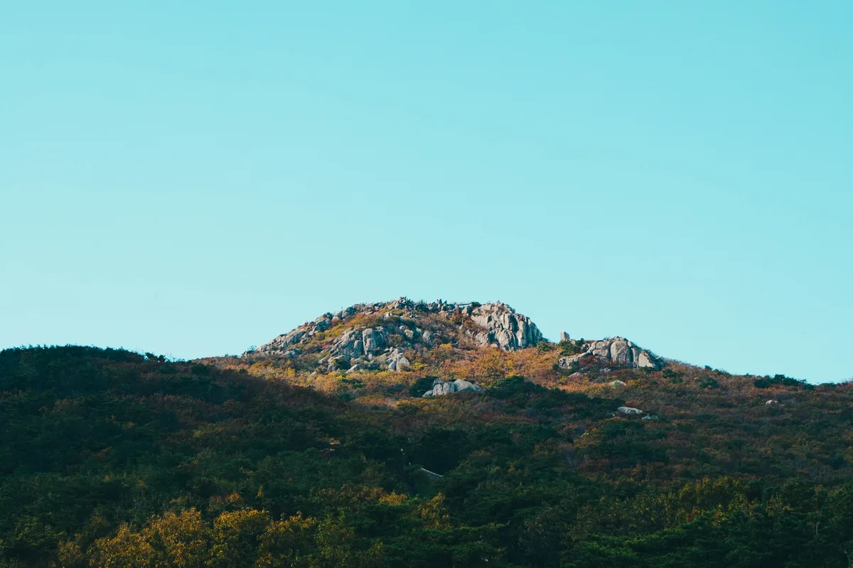
The Baekdudaegan is the spine that every other Korean mountain hangs from. Running 1,400 to 1,625 kilometers in total from Baekdusan in the far north to Jirisan in the south, it is the longest continuous mountain system on the Korean Peninsula. The South Korean section runs 701 kilometers from Hyangnobong in Gangwon Province's Goseong County to Cheonwangbong on Jirisan in South Gyeongsang's Sancheong County. This is not a national park. It is a protected corridor — designated under the Baekdudaegan Protection Act in 2000 — that cuts across nine national parks, several provincial parks, and some of the wildest high country in South Korea.
Fewer than 2,000 Korean hikers have ever officially completed the South Korean Baekdudaegan as a continuous traverse. The standard approach is "section hiking" — breaking the 701 kilometers into 10 to 30-kilometer segments and walking them over two years or more, usually with an organized hiking club or tour company. International hikers almost never attempt the full trail; most instead hike key sections inside the individual national parks that the Baekdudaegan passes through. That is the approach this guide recommends and the reason the individual mountain articles matter more than the hub article for most visitors.
The Baekdudaegan was almost erased from Korean geography twice — once by Japanese colonial cartography that replaced the traditional mountain-spine system with disconnected "mountain ranges" based on geological structure, and a second time through Japanese-era logging of the primary-growth pine forests along the ridge from 1913 onward. It was rediscovered for the modern era in the 1980s when amateur cartographer Lee Woo-hyeong found an old copy of the Sangyeongpyo (산경표), the 18th-century Joseon treatise on Korean mountain lineages by the Silhak scholar Shin Gyeong-jun. The Sangyeongpyo approached mountains the way a family genealogy approaches people — tracing ancestral connections from the great trunk (daegan) through branches (jeong-gan) and sub-branches (jeong-maek). That framework is the reason "Baekdudaegan" exists as a concept; Japanese colonial geology had replaced it with a grid of named ranges that broke the spine into disconnected pieces.
In 2000 Korea formally restored the Baekdudaegan in national policy. The Forest Service now manages it. A 198-kilometer section runs inside the national park trail network with official signage and shelters; a 77-kilometer segment is in absolute-protection zones that require special access permits. The rest runs through provincial and forest-service land with varying levels of access. For international visitors, the practical approach is to choose one or two of the national parks along the spine and hike the Baekdudaegan sections within them — which is what the individual mountain guides below are built to support.
Quick Info
Quick summary for planning your Baekdudaegan experience at a glance.
- Total Length: ~1,400–1,625 km (full peninsula); 701 km in South Korea
- Southern Terminus: Cheonwangbong, Jirisan (1,915m) — Sancheong, Gyeongnam
- Northern Terminus (South Korea): Hyangnobong — Goseong, Gangwon
- Legal Protection: Baekdudaegan Protection Act (2000), managed by Korea Forest Service
- Section Classification: 198 km inside national parks • 77 km in absolute-protection zones • remainder on provincial/forest land
- Completion Rate: Fewer than 2,000 Koreans have completed the full 701-km traverse
- Recommended Approach: Section hiking (10–30 km segments over 2+ years)
- Main National Parks on the Spine: Jirisan, Deogyusan, Sokrisan, Sobaeksan, Woraksan, Taebaeksan, Odaesan, Seoraksan
- Best Season: September–October (stable weather, foliage); April–May (wildflowers, mild temperatures)
- International Visitor Approach: Hike key sections within the individual national parks
The Regions of the Baekdudaegan
The South Korean Baekdudaegan is typically divided into six to seven regional segments, south to north. Each is dominated by one or two signature mountains, and each mountain has its own guide in this series.
| Region | Distance | Signature Mountain(s) | Difficulty | Entry Point Guide |
|---|---|---|---|---|
| Jirisan | ~100 km | Jirisan (1,915m), Cheonwangbong | Moderate–Advanced | Jirisan |
| Deogyusan–Muju | ~75 km | Deogyusan (1,614m) | Moderate | Deogyusan |
| Sokrisan–Munyeong | ~60 km | Sokrisan (1,058m) | Moderate | Songnisan |
| Sobaeksan | ~80 km | Sobaeksan (1,439m) | Moderate | Sobaeksan |
| Taebaeksan | ~70 km | Taebaeksan (1,567m) | Moderate | Taebaeksan |
| Odaesan–Jinbu | ~60 km | Odaesan (1,563m) | Moderate | Odaesan |
| Seoraksan–Hyangnobong | ~80 km | Seoraksan (1,708m) | Advanced | Seoraksan |
Why the Baekdudaegan Matters
The Spine That Sorts Korea's Water
Every major river in South Korea — the Han, the Nakdong, the Geum, the Yeongsan, the Seomjin — has its headwaters on one side or the other of the Baekdudaegan. The ridge is the primary watershed of the peninsula. On the eastern flank, streams drain into the East Sea (Sea of Japan); on the western flank, they drain into the Yellow Sea or the South Sea.
The Han and Nakdong split along the middle sections of the spine — through Sobaeksan, Jungnyeong Pass, Gyerimnyeong Pass, Ihwanryeong Pass, and Sokrisan. The Geum is bordered on the east by the southern middle sections — Chupungnyeong Pass, Hwanghaksan, Samdobong, Deogyusan, Yuksimnyeong Pass, Yeongchwisan. The Yeongsan and Seomjin split at the southern terminus, Jirisan itself. This hydrographic centrality is why the Baekdudaegan was traditionally understood as the source of the peninsula's vital energy — the meridian line that gave every region its water, its soil, and its weather.
The Sangyeongpyo and the Traditional Mountain System
The 18th-century treatise Sangyeongpyo (산경표), attributed to the Silhak scholar Shin Gyeong-jun, organized Korean mountains in a genealogical system. The great trunk (daegan) runs the length of the peninsula. From it, major branches called jeong-gan extend east or west. From the jeong-gan, smaller branches called jeong-maek extend further. Every named mountain in Korea could be traced, under this system, to its position in the family tree of ridges.
This was not a theoretical model. It was a mental map that structured traditional Korean understandings of geography, provincial boundaries, dialect regions, and even marriage patterns. Until the colonial era it was the framework most educated Koreans carried in their heads when they thought about the country's shape.
Japanese Colonial Erasure and Modern Restoration
In 1903 the Japanese geologist Koto Bunjiro published a survey of Korea's geology that replaced the traditional mountain-spine model with a system of disconnected geological "mountain ranges" — the Taebaek Range, the Sobaek Range, the Charyeong Range, the Noryeong Range, the Masingnyeong Range. This framework presented Korea's geography as a set of unrelated pieces rather than a continuous spine. It persisted through the colonial period (1910–1945) and into post-liberation Korean textbooks.
The physical erasure was more damaging than the conceptual one. Under colonial authority, from 1913 onward, Japanese logging companies worked their way along the Baekdudaegan ridge systematically harvesting the old-growth Korean red pine (금강소나무) forests. Tokyo Imperial University academic expeditions documented and facilitated much of this extraction. The primary-growth forest that had defined the ridge for millennia was largely destroyed in one generation.
The 1980s rediscovery — Lee Woo-hyeong finding a Sangyeongpyo copy in an Insa-dong antique bookshop — restored the concept to academic visibility. Through the 1990s, amateur hikers began attempting full Baekdudaegan traverses. In 2000 the National Assembly passed the Baekdudaegan Protection Act, and the Korea Forest Service formally designated the 701-kilometer corridor as a protected national heritage.
The Section-Hiking Approach
Why Section Hiking
A continuous 701-kilometer thru-hike of the Baekdudaegan is possible and has been done, but the logistics are daunting even for Korean hikers. Mountain shelters must be booked one to two months in advance through the Korean National Park Service. The corridor crosses absolute-protection zones that require permits. Wilderness camping is largely illegal in South Korea's national parks. Water sources along the ridge are limited. Logistics between remote trailheads require vehicle shuttles.
Section hiking — 10 to 30 kilometers per trip, usually on weekends — breaks these problems into solvable pieces. Most Korean hikers who complete the full Baekdudaegan do so over roughly two years of monthly or bi-monthly trips organized by a hiking club. Several Korean hiking companies run full Baekdudaegan programs, with groups progressing through sequential sections on a shared multi-year schedule.
The Practical Strategy for International Visitors
For most international hikers, the realistic approach is to skip the idea of completing the full Baekdudaegan and instead hike the sections that fall within individual national parks. The national park sections are the most scenic, best maintained, best signposted, and most accessible. They include shelters, visitor centers, and clear trail maps. They can be completed as stand-alone day or multi-day hikes without the organizational overhead of a full thru-hike attempt.
The mountains to prioritize, south to north: Jirisan (the southern terminus — the Seongjeongneung traverse or the Cheonwangbong-Banyabong ridge is the main Baekdudaegan experience on the mountain), Deogyusan (the Hyangjeokbong ridge, Korea's 4th-highest peak), Sokrisan, Sobaeksan (the Birobong-Gukmangbong ridge is pure Baekdudaegan terrain), Taebaeksan (Korea's spiritual altar mountain), Odaesan (central Gangwon's pristine ridgeline), and Seoraksan (the Baekdudaegan's most dramatic rock country — Daecheongbong and the Gongnyong Ridge).
Joining Organized Groups
For visitors who want the full Baekdudaegan experience without solo logistics, Korean hiking tour companies run multi-year group programs. Typical structure: a group hikes a 15 to 25-kilometer section every four to eight weeks, progressing sequentially through the trail over about two years. Fees run roughly ₩50,000 to ₩100,000 per trip including transport and guide; shelter fees are separate. Most groups conduct business in Korean, though some English-capable guides exist.
For non-Korean-speaking international visitors, a realistic compromise is joining one or two sections with a group that accommodates English — often in the Jirisan, Sobaeksan, or Seoraksan regions — or hiking solo on the well-marked national park portions and treating the Baekdudaegan as a conceptual frame rather than a goal.
Regions of the Baekdudaegan: Detailed Guide
Jirisan Region — The Southern Terminus
The Baekdudaegan ends (or begins, depending on direction) at Cheonwangbong, the 1,915-meter summit of Jirisan and the highest mainland peak in South Korea. The classic Baekdudaegan entry on Jirisan is the Seongjeongneung — the "Sacred Ridge" — running from Cheonwangbong west through Jangteogmok, Byeoksoryeong, Hyeongjebong, Deokpyeongbong, Banyabong, and out to Nogodan. Roughly 25 to 28 kilometers of ridge walking, typically a 2 to 3-day traverse with overnight stays at Jangteogmok or Byeoksoryeong shelters (advance booking required).
For a single-day Baekdudaegan taste, the Cheonwangbong sunrise — typically from the Jungsanri trailhead up to Rotary Shelter and on to the summit — delivers the southern terminus view in about 10 hours round trip.
Full guide: Jirisan Hiking Guide
Deogyusan Region — The Fourth-Highest Peak
Deogyusan rises to 1,614 meters at Hyangjeokbong, making it Korea's fourth-highest mainland peak. The Baekdudaegan runs along the high ridge, and the signature routes include the Hyangjeokbong traverse and the long ridge walks from Deokyu's subsidiary peaks. In winter, Deogyusan is known for heavy snow and dramatic rime-ice formations on the ridge — a colder and more dramatic counterpart to Taebaeksan's snow flowers.
The Muju Wine Cave and Deogyusan's temple-and-valley access routes give non-Baekdudaegan-focused visitors a full park visit outside of ridge hiking.
Sokrisan Region — The Middle Mountains
Sokrisan (1,058m) is the main feature of the middle Baekdudaegan, with a distinctive rocky summit region and the Beopjusa Temple complex at its base. The Baekdudaegan crosses through the northern part of the park and continues north across Mun-gyeong-ssae-jae — the historic pass that connected the old Gyeongsang and Chungcheong provinces during the Joseon period.
Sobaeksan Region — The Royal Azalea Ridge
Sobaeksan's Birobong (1,439m) to Gukmangbong ridge is one of the most picturesque continuous Baekdudaegan sections. In late May and early June, royal azaleas bloom in dense ridge-line patches; in winter, the Korean edelweiss habitat and ancient yew grove (Natural Monument #244) take over as the visual draws. Jungnyeong Pass — the historic mountain pass that separated ancient Silla and Baekje — is the traditional midpoint.
Full guide: Sobaeksan Hiking Guide
Taebaeksan Region — The Sacred Spine
Taebaeksan (1,567m) was Korea's 22nd national park designation (2016) and holds the Cheonjedan, the ancient altar where state-level heaven rituals were performed. The Baekdudaegan runs directly through the summit and continues north along the ridgeline. Winter snow-flower season (mid-December to mid-February) is among the most photographed alpine phenomena in Korea, and the ancient yew forest between Janggunbong and Cheonjedan includes individual trees over 1,000 years old.
Full guide: Taebaeksan Hiking Guide
Odaesan Region — The Pristine Ridge
Odaesan (1,563m at Birobong) is one of the best-preserved forest sections of the Baekdudaegan. The original-growth forest density is noticeably higher than on the southern mountains, and the park is known as a "mountain vegetable paradise" — Jinbu-myeon's signature meal, a sanchae-jeongsik featuring 25 or more wild mountain vegetables, is one of the defining regional food experiences along the ridge. The Woljeongsa fir forest at the base is one of Korea's three great fir forests (alongside Naesosa and the Gwangneung Arboretum).
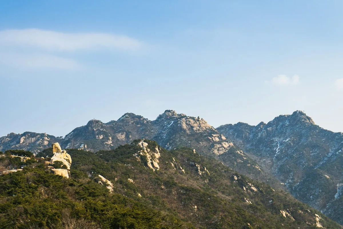
Seoraksan Region — The Northern Terminus
The northern 80 kilometers of the South Korean Baekdudaegan run through the Seoraksan region, ending at Hyangnobong on the DMZ buffer zone. Seoraksan itself — the section most international hikers recognize — contains the highest drama: Daecheongbong (1,708m), the Gongnyong Ridge ("Dinosaur Ridge"), Madeungryeong, and the Biryong Falls complex. This is the most technical section of the full Baekdudaegan, with rope-assisted rock segments, exposed ridge walking, and strict weather-dependent access.
Full guide: Seoraksan Hiking Guide
Choosing Your Entry Point
For first-time Korean hikers: start with Jirisan or Seoraksan. Both are the most internationally known, have the best English-language infrastructure, and offer the most dramatic scenery. Jirisan's Cheonwangbong sunrise or Seoraksan's Daecheongbong are the classic introductions.
For photographers: the Sobaeksan Birobong ridge in late May (azaleas) or Taebaeksan's Cheonjedan in mid-January (snow flowers) are among the most iconic Baekdudaegan landscapes.
For history-minded visitors: Taebaeksan (Cheonjedan altar), Sobaeksan (Jungnyeong Pass, Silla-Baekje border), and Odaesan (Woljeongsa Temple and Sangwonsa) form a three-mountain heritage traverse.
For serious hikers wanting a Baekdudaegan signature traverse: the Seongjeongneung on Jirisan (Cheonwangbong to Nogodan) is the most complete single-mountain Baekdudaegan experience — 25 to 28 kilometers, 2 to 3 days, and the southern terminus in hand.
For those who want a named Baekdudaegan pass but not a full traverse: Jungnyeong Pass (Sobaeksan) and Mun-gyeong-ssae-jae (Sokrisan) are both historically significant crossings that can be visited in a day.
Tips Before You Go
- Mountain shelters require advance booking. Reserve through the Korean National Park Service (knps.or.kr) typically one to two months ahead. October weekends and spring azalea weekends book out fastest.
- Wilderness camping is largely prohibited in Korean national parks. Use designated shelters or official campgrounds only.
- No open fires, no portable cooking stoves inside national parks. Cook in designated shelter kitchens only.
- Detailed English-language guidebook: Baekdu Daegan Trail: Hiking Korea's Mountain Spine by Roger Shepherd and Andrew Douch (Seoul Selection, 2007) remains the standard reference.
- Navigation: the Naver Maps and Kakao Map Korean apps have better accuracy than Google Maps in rural Korean terrain. Offline map downloads are essential for longer section hikes.
- Trail closures: the Korea National Park Service enforces seasonal closures on some sections for erosion recovery, wildlife protection, or fire risk. Check the knps.or.kr site before any multi-day trip.
- Weather: the ridge runs 5 to 10 degrees cooler than base elevation. Pack layers year-round. Summer afternoon thunderstorms (typically 2 to 4 PM) are common June through August.
- Language: English signage exists at major national park trailheads and visitor centers, but ridge-trail signage is generally Korean only. Save key trail names in Korean script before heading out.
- Registration: informing a local police station or a friend of your hiking plan is recommended but not legally required for organized groups.
- Emergency: 119 (ambulance/fire/rescue) nationwide. Cell coverage is generally strong on Korean ridge trails but can be weak in deep valleys.
How to Get There
The Baekdudaegan is not a single trailhead. Access depends entirely on which section you are hiking. The following are the principal access cities for each regional segment.
Jirisan: most often accessed from Sancheong (Jungsanri trailhead) or Gurye (Hwaeomsa trailhead). Roughly 4 to 4.5 hours from Seoul by bus or car. KTX to Gurye-Gokseong Station or Namwon Station for the western trailheads.
Deogyusan: Muju or Geochang. Approximately 3 to 3.5 hours from Seoul by bus or car.
Sokrisan: Boeun, North Chungcheong Province. Approximately 2.5 hours from Seoul by bus or car.
Sobaeksan: Danyang or Yeongju. Approximately 2.5 to 3 hours from Seoul by train or bus. KTX to Danyang Station.
Taebaeksan: Taebaek City, Gangwon Province. Approximately 3 hours from Seoul by bus. Taebaek Station via Mugunghwa train.
Odaesan: Pyeongchang or Gangneung. Approximately 2.5 hours from Seoul by bus or car. KTX to Pyeongchang or Gangneung stations.
Seoraksan: Sokcho. Approximately 2.5 to 3 hours from Seoul by bus or car. No direct KTX; the fastest route is the Seoul–Sokcho express bus.
Use Naver Maps or Kakao Map for real-time navigation.
Final Thoughts
The Baekdudaegan is not a trail you visit once and tick off a list. It is the spatial framework of Korean mountain identity — the line that sorts the rivers, marks the provinces, and gives the peninsula its shape. Fewer than 2,000 Korean hikers have completed the full 701-kilometer South Korean traverse, and for international visitors a full thru-hike is neither realistic nor necessary. The accessible path is to choose the two or three regions that match your interests, hike the signature ridgelines inside each, and treat the full Baekdudaegan as the conceptual geography that connects them.
Jirisan and Seoraksan are the natural bookends. Sobaeksan is the middle ridge with the deepest seasonal variety. Taebaeksan is the sacred center. Odaesan is the pristine forest. Deogyusan is the winter drama. Pick any two, hike the ridge sections within each, and you will have experienced more of the Baekdudaegan than most visitors who fly in specifically looking for it.
For the best hikes reachable directly from Seoul by subway, see the full Seoul hiking guide.
Related Guides — Mountains Along the Baekdudaegan
Explore more hiking in Korea:
- Best hikes in Seoul — full overview of Seoul's mountains by subway
- Jirisan Hiking Guide — mainland Korea's highest summit and southern terminus of the Baekdudaegan
- Seoraksan Hiking Guide — northern Baekdudaegan's most dramatic rock country
- Hallasan Hiking Guide — Jeju Island's volcanic UNESCO summit (separate from the Baekdudaegan)
- Naejangsan Hiking Guide — Korea's premier autumn foliage mountain (near the spine)
- Wolchulsan Hiking Guide — Cloud Bridge and dramatic granite peaks of Korea's southwest
- Taebaeksan Hiking Guide — sacred altar mountain on the central Baekdudaegan
- Sobaeksan Hiking Guide — royal azalea ridge and UNESCO heritage academies
- Juwangsan Hiking Guide — UNESCO Geopark volcanic gorge in the Taebaek mountains
- Byeonsanbando Hiking Guide — Korea's only peninsula national park
- Hwangmaesan Hiking Guide — royal azalea plateau and drive-up summit
- Geumosan Hiking Guide — Korea's first provincial park and Confucian heritage
FAQ
What is the Baekdudaegan? The Baekdudaegan (백두대간, "White-Head Great Trunk") is the principal mountain spine of the Korean Peninsula, running approximately 1,400 to 1,625 kilometers from Baekdusan in the north to Jirisan in the south. The South Korean section runs 701 kilometers from Hyangnobong in Goseong County to Cheonwangbong on Jirisan. It has been protected since 2000 under the Baekdudaegan Protection Act and is administered by the Korea Forest Service.
Can foreign hikers complete the full Baekdudaegan? It is technically possible but logistically difficult. Fewer than 2,000 Korean hikers have officially completed the 701-kilometer South Korean section as a continuous traverse, and most Koreans who finish do so over two or more years of section hikes. For international visitors, the practical approach is section hiking — typically starting within major national parks like Jirisan, Sobaeksan, Taebaeksan, or Seoraksan.
How long does it take to complete the Baekdudaegan? A continuous thru-hike of the South Korean section typically takes 45 to 60 days. Section hiking over two years is the most common approach, with groups or individuals hiking 15 to 25-kilometer segments every 4 to 8 weeks.
What is the best single Baekdudaegan section for a first-time visitor? The Seongjeongneung ridge on Jirisan — from Cheonwangbong through Banyabong to Nogodan — is the most classic single-mountain Baekdudaegan experience. It requires 2 to 3 days with overnight shelter stays and covers approximately 25 to 28 kilometers along the actual Baekdudaegan ridge including the southern terminus.
When is the best season to hike the Baekdudaegan? September and October for stable weather, clear skies, and peak autumn foliage. Late April through May for mild temperatures, wildflowers, and the royal azalea bloom on the middle sections (Sobaeksan especially). Summer is hot with afternoon thunderstorm risk; winter brings significant snow and ice on the ridge and is recommended only for experienced winter hikers.
How do I book mountain shelters along the Baekdudaegan? Through the Korea National Park Service website (knps.or.kr) typically one to two months in advance. Weekends in October (autumn foliage) and late May (azalea season) book out fastest. Shelter fees run approximately ₩20,000 to ₩30,000 per night. Bring your own sleeping bag; only sleeping mats are provided.
Continue exploring Korea's mountains
More routes, same honest field notes.
Related guides

Same region
ExpertJirisan Hiking Guide: Cheonwangbong and Ridge Traverse
A practical guide to hiking Jirisan National Park — South Korea's highest mainland peak at 1,915m, with Nogodan day hike, ridge traverse, and shelter info.

Similar hike
HardBukhansan Hiking Guide: Baegundae Summit in Seoul
A practical guide to hiking Bukhansan National Park in Seoul — Baegundae summit routes, Bukhansanseong Fortress, Insubong rock climbing, and subway access.

Similar hike
EasyByeonsanbando Hiking Guide: Sea Cliffs and Naesosa
A practical guide to hiking Byeonsanbando — Korea's only peninsular national park, with Chaeseokgang UNESCO sea cliffs, Jikso Falls, and Naesosa fir forest.