Jirisan Hiking Guide: Cheonwangbong and Ridge Traverse
A practical guide to hiking Jirisan National Park — South Korea's highest mainland peak at 1,915m, with Nogodan day hike, ridge traverse, and shelter info.

Jirisan is the mountain that defines Korean hiking. At 1,915 meters, Cheonwangbong — "Peak of the Heavenly King" — is the highest point on the South Korean mainland. The park covers 472 square kilometers across three provinces and five counties. It was the first national park designated in Korea, in 1967. The name means "Mountain Where Wise People Gather," and for 1,400 years, they have.
The scale here is different from anything else in this guide. The main ridge runs 25.5 kilometers from Nogodan in the west to Cheonwangbong in the east, maintaining an average elevation above 1,500 meters. Most hikers split it over two or three days, sleeping in mountain shelters that require advance reservation. The sunrise from Cheonwangbong — looking out over a sea of clouds with the southern coast visible on clear days — is the single most celebrated mountain view in Korea.
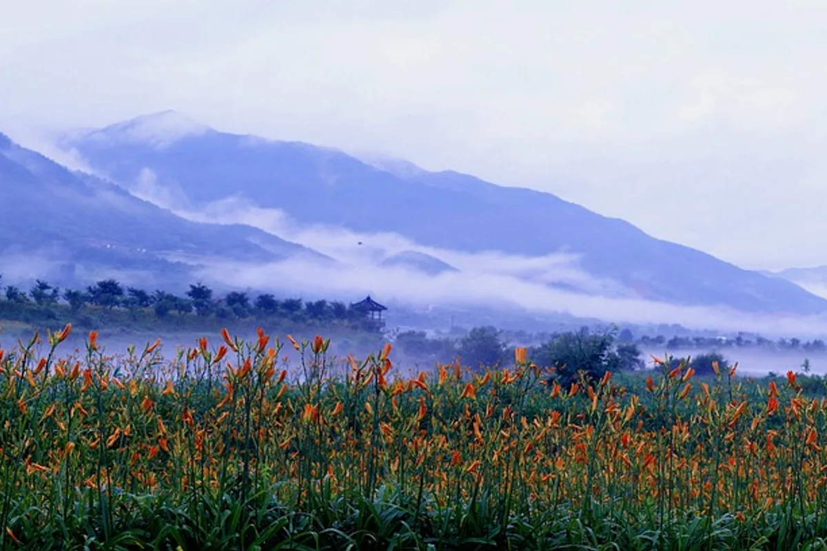
But Jirisan does not require a multi-day commitment. The Nogodan day hike from Seongsamjae — 5 to 6 kilometers round trip, 3 to 4 hours, through alpine meadows at 1,500 meters — is one of the most accessible high-altitude walks in the country. And Piagol Valley in October, when the entire gorge turns crimson and the locals say even the water runs red, is a standalone autumn destination.
Seven major Buddhist temples sit around the mountain's base. Asiatic black bears — reintroduced from Russia in 2004 — now number roughly 80 to 90 in the park. And the mountain's modern history is as heavy as its ancient: Jirisan was the last stronghold of partisan fighters after the Korean War, and the deep valleys still carry that weight.
Quick Info
Quick summary for planning your Jirisan hike at a glance.
- Location: Hadong / Sancheong / Hamyang (Gyeongsangnam-do), Gurye (Jeollanam-do), Namwon (Jeollabuk-do), South Korea
- Highest Peak: Cheonwangbong, 1,915m (mainland South Korea's highest)
- Park Area: 472 km² (Korea's largest land-based national park)
- Difficulty: Easy (Nogodan) to Expert (Chilsun Valley, winter traverse)
- Best Time to Visit: October (autumn foliage), May–June (alpine flowers), year-round for ridge traverse
- Entrance Fee: Free (shelter fees separate)
- Park Designation: 1st National Park (1967)
- Reservations: Required for Nogodan, Seseok (Jun–Sep), and all mountain shelters
- Travel Time from Seoul: 4–5 hours by car or KTX + bus
Trail Overview
| Trail | Distance | Elevation Gain | Time | Difficulty | Best For |
|---|---|---|---|---|---|
| Nogodan Day Hike | 5–6km round trip | +330m | 3–4h | Easy–Moderate | Alpine meadow, sea of clouds |
| Cheonwangbong Day Hike (Jungsanri) | 14km round trip | +1,800m | 8–10h | Hard | Summit, sunrise, fit hikers |
| Ridge Traverse (2–3 days) | 25.5km | +600m cumulative | 2–3 days | Hard | Full Jirisan experience |
| Piagol Valley | 3–10km | varies | 4–8h | Moderate | Autumn foliage |
| Chilsun Valley | 16km | extreme | 2–3 days | Expert | Primeval forest, waterfalls |
Why Jirisan Is the Mountain That Matters
Every mountain in this guide has a reason to visit. Jirisan has all of them — and adds the one thing none of the others can: the highest point on the mainland.
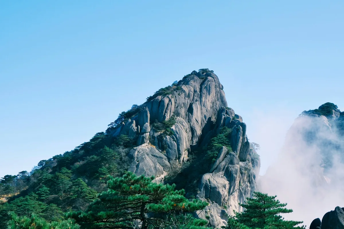
The ridge traverse from Nogodan to Cheonwangbong is the defining multi-day hike in Korean mountaineering. The 25.5 kilometers cross alpine meadows, subalpine forest — including Korean fir communities threatened by climate change — and exposed granite ridgelines before arriving at a summit where the sea of clouds is not a metaphor. On clear mornings, the southern coast is visible 50 kilometers away.
The cultural layers run deeper here than anywhere else. Hwaeomsa Temple (founded during the Silla Dynasty, holding five National Treasures) anchors the southwestern base. Ssanggyesa, Cheoneunsa, Silsangsa, and Daewonsa — four major mountain monasteries — ring the mountain. Nogodan, the western summit, is named after Mago, the grandmother goddess of Korean mountain mythology. The mountain has been sacred for as long as Korean civilization has existed.
The ecological restoration is real and ongoing. Asiatic black bears, extinct in South Korea, were reintroduced to Jirisan from Russia in 2004. Roughly 80 to 90 now live in the park — the only self-sustaining population in the country. Bear warning signs are posted on multiple trails. This is not theoretical wildlife management; it is an active bear habitat.
For comparison, Seoraksan has more dramatic granite towers but lower elevation. Deogyusan offers gondola access to 1,600 meters but a shorter ridge. Gayasan has double UNESCO heritage but smaller scale. Jirisan is where all those elements — summit elevation, cultural depth, ecological significance, and multi-day trail infrastructure — converge in one park. If you only hike one mountain in Korea, this is the one.
Difficulty and Time Required
Jirisan spans the full difficulty spectrum, and the gap between the easiest and hardest options is larger than on any other Korean mountain.
The Nogodan day hike is genuinely accessible — 330 meters of elevation gain on a well-maintained trail, 3 to 4 hours round trip, suitable for most adults in reasonable fitness. Reservation is required.
The Cheonwangbong day hike from Jungsanri is a different mountain entirely. The 14-kilometer round trip gains 1,800 meters of elevation — more vertical gain than most Korean hikers encounter in a season. Start at 3am for the summit sunrise. This is for very fit, experienced hikers only.
The ridge traverse is the standard multi-day approach, split over 2 or 3 days with shelter stays. The hiking itself is not technical — no ropes, no scrambling — but the sustained distance at altitude, the weather exposure on the ridge, and the logistics of shelter reservations make it a serious undertaking.
Chilsun Valley — the "Valley of Death" — is in a category of its own. Sixteen kilometers of primeval gorge with 7 waterfalls and 33 natural pools, unimproved terrain, and a history of fatalities. Experienced mountaineers only.
Trail Options
Nogodan Day Hike — Most Accessible
The easiest way to experience Jirisan's high altitude. From Seongsamjae Pass (1,180m), the trail climbs 330 meters through alpine grassland to Nogodan summit at 1,507 meters. On clear mornings, the sea of clouds fills the valleys below — one of the most photographed phenomena in Korean hiking.
In summer, wildflowers cover the meadows: Siberian lily, day lily, and meadowsweet. The subalpine vegetation at this elevation is distinct from anything in the Seoul mountains.
Reservation required. All Nogodan visits must be booked in advance through the Korea National Park Service website. Round trip takes 3 to 4 hours. Return by early afternoon.
Best for: First-time Jirisan visitors, families, photographers, anyone wanting high-altitude scenery without a multi-day commitment.
Ridge Traverse (2–3 Days) — The Defining Hike
The 25.5-kilometer traverse from Seongsamjae to Jungsanri via the main ridge is the signature Korean multi-day hike. Most hikers split it over 2 or 3 days, staying in mountain shelters along the ridge.
Day 1: Seongsamjae → Nogodan → Seseok Shelter (13km, 7–8h)
From Seongsamjae Pass, the trail climbs to Nogodan and then follows the ridge east through Hwaegaejae Pass, Tokkibong, and Byeoksoryeong to Seseok Shelter. The walking is mostly exposed ridge — rocky sections with good footing, consistent elevation change, and views in every direction. Seseok Shelter is a high-standard facility requiring advance reservation.
Day 2: Seseok → Jangteomok → Cheonwangbong (12km, 6–7h)
The ridge continues east through increasingly dramatic terrain. Korean fir and birch forests line the upper slopes. Jangteomok Shelter — another high-standard facility — sits roughly 5 kilometers from Cheonwangbong. Many hikers stay here to summit at dawn.
The sunrise from Cheonwangbong is the payoff. At 1,915 meters, above the cloud layer, looking south toward the coast — this is the view that defines Korean mountain hiking.
Day 3: Cheonwangbong → Jungsanri (7km, 3–4h)
The descent through Jayugigol Valley drops steeply from the summit to the Jungsanri trailhead. The trail is clearly marked with some stream crossings.
Shelter reservations are mandatory and should be booked 1 to 2 months in advance during peak seasons (July–August, October–November). Shelters cost 8,000–15,000 KRW per night. Bedding is provided but bring a sleeping bag liner.
Seseok special protection zone: From June through September (2025 onward), the Geolim–Seseok section requires advance reservation for day visitors as well, due to ecosystem restoration.
Best for: The full Jirisan experience, multi-day hikers, sunrise from Korea's highest mainland peak.
Cheonwangbong Day Hike — Summit Without Overnight
The Jungsanri approach covers 14 kilometers round trip with 1,800 meters of elevation gain. This is a brutal day hike — more vertical than most Alpine routes of similar distance — and should only be attempted by fit, experienced hikers.
Depart the trailhead at 3am for a summit sunrise. The trail climbs steeply through Jayugigol Valley on a well-marked but relentless path. Allow 5 to 6 hours ascending, 3 to 4 hours descending.
Best for: Very fit hikers who want the summit without shelter logistics, sunrise seekers.
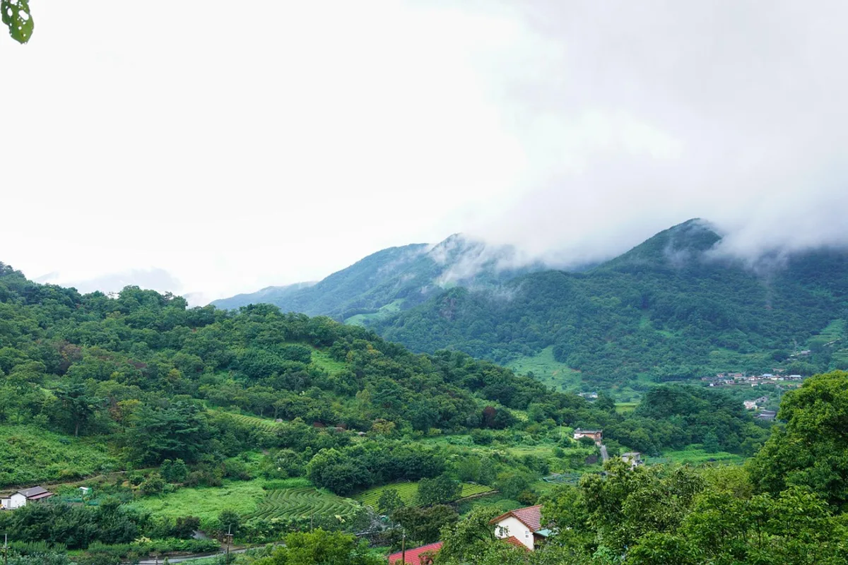
Piagol Valley — Best Autumn Foliage
Piagol sits between Nogodan and Banyabong, and in October the entire valley turns crimson — one of Jirisan's Ten Scenic Views. The name originally meant "millet field valley" from historical agriculture on the slopes. The dense forest surrounding an ice-cold stream creates a microclimate that holds autumn color longer than surrounding areas.
Variable routes from 3 to 10 kilometers, 4 to 8 hours depending on depth. The shorter options are suitable for intermediate hikers.
Best for: October foliage photography, valley hiking, intermediate day hikers.
Chilsun Valley — Expert Only
Korea's top three valleys include Chilsun — 16 kilometers of primeval gorge with 7 waterfalls and 33 natural pools. The terrain is unimproved, the scrambling is serious, and the valley has earned the nickname "Valley of Death." Allow 2 to 3 days. Do not attempt without mountaineering experience, rope skills, and a partner.
Best for: Expert mountaineers only.
Best for Most Travelers
If you have one day: the Nogodan day hike from Seongsamjae — alpine meadows at 1,500 meters, sea of clouds on clear mornings, 3 to 4 hours round trip.
If you have two days: the ridge traverse from Seongsamjae to Cheonwangbong with one night at Seseok or Jangteomok Shelter — the sunrise from Korea's highest mainland summit is worth the shelter reservation effort.
If you're not sure: start with Nogodan.
Who Should Do This Hike
Jirisan is the mountain that serious Korean hikers build toward. The ridge traverse is a rite of passage — but it requires multi-day planning, shelter reservations, proper gear, and fitness for sustained ridge walking at 1,500 meters.
The Nogodan day hike removes all of those barriers. It is the best way to experience Jirisan's high altitude, alpine character, and sea of clouds without an overnight commitment. Anyone in moderate fitness can complete it.
Between the two extremes, Piagol Valley in autumn offers a standalone day hike through one of the finest autumn foliage gorges in the country. The Cheonwangbong day hike from Jungsanri is available to very fit hikers who want the summit without shelter logistics.
Bear awareness is necessary on all Jirisan trails. Asiatic black bears are present throughout the park. Store food properly, make noise on the trail, and follow posted guidelines.
Tips Before You Go
- Reservations are required for Nogodan (all visits), Seseok zone (June–September), and all mountain shelters. Book 1 to 2 months ahead for peak season.
- Bring at least 2 liters of water for the Nogodan day hike, 3 liters for the Cheonwangbong day hike. Water on the ridge is extremely limited — fill up at shelters.
- Mountain shelters provide bedding but not sleeping bags. Bring a liner and warm layers — ridge temperatures drop 10–15°C below the base.
- The Cheonwangbong sunrise requires a 3am departure from Jungsanri or an overnight at Jangteomok Shelter. Plan transportation accordingly.
- Asiatic black bears are present. Store food in provided bear containers at shelters. Do not leave food unattended on the trail.
- Seasonal closures apply for fire prevention (spring and autumn). Check the Korea National Park Service website before visiting.
- In winter, crampons and alpine experience are essential. Winter Jirisan is a serious mountaineering environment.
- Emergency number: 119. Cell coverage is limited on the ridge — do not rely on it.
How to Get There
Nogodan / Seongsamjae (western access): From Seoul, take KTX to Gurye-Guryeoguchi Station (approximately 2.5 hours) or drive approximately 4 hours. From Gurye, taxi or local bus to Seongsamjae Pass (approximately 40 minutes).
Cheonwangbong / Jungsanri (eastern access): From Seoul, drive approximately 4.5 hours via Tongyeong-Daejeon Expressway to Sancheong-gun, then local roads to Jungsanri trailhead. Express bus options available via Jinju or Sancheong.
Between trailheads: The traverse is point-to-point. Arrange return transportation in advance — taxi between Seongsamjae and Jungsanri takes approximately 2 hours.
Use Naver Maps for real-time transit directions on the day.
Final Thoughts
Jirisan is the mountain where Korean hiking begins and ends. The first national park. The highest mainland summit. The longest ridge traverse. The deepest valleys. The oldest temples. The only wild bear population in the country.
The Nogodan day hike delivers the high-altitude experience in 3 to 4 hours. The ridge traverse delivers the summit sunrise that every Korean hiker talks about. And somewhere in between — in the crimson valleys of Piagol, in the 1,400-year-old temples at the base, in the Korean fir forests that are slowly dying on the upper slopes — there is a mountain that has been central to Korean culture for as long as Korea has existed.
You can hike every other mountain in this guide and still not have hiked Jirisan. It is the one you come back for.
For the best hikes reachable directly from Seoul by subway, see the full Seoul hiking guide.
Related Guides
Explore more hiking in Korea:
- Best hikes in Seoul — full overview of Seoul's mountains by subway
- Seoraksan Hiking Guide — Korea's most famous hiking destination
- Deogyusan Hiking Guide — gondola summit and ridge traverse
- Gayasan Hiking Guide — double UNESCO heritage near Hapcheon
- Hallasan Hiking Guide — South Korea's highest peak on Jeju Island
FAQ
How difficult is the Jirisan ridge traverse? The 25.5-kilometer traverse is rated Hard. It is typically split over 2 to 3 days with mountain shelter stays. The trail is not technical — no ropes or scrambling — but the sustained distance at altitude, weather exposure, and logistics require experience and fitness. Shelter reservations must be booked well in advance.
Can I hike Cheonwangbong as a day trip? Yes, from the Jungsanri trailhead. The 14-kilometer round trip gains 1,800 meters of elevation and takes 8 to 10 hours. Depart at 3am for the summit sunrise. This is only suitable for very fit, experienced hikers.
Do I need a reservation for Nogodan? Yes. All visits to Nogodan require advance reservation through the Korea National Park Service website. The 5 to 6 kilometer round trip takes 3 to 4 hours and is the most accessible high-altitude hike on Jirisan.
Are there bears on Jirisan? Yes. Roughly 80 to 90 Asiatic black bears live in the park, reintroduced from Russia starting in 2004. Bear warning signs are posted on multiple trails. Store food in provided containers at shelters and follow posted safety guidelines.
When is the best time to visit Jirisan? October for Piagol Valley autumn foliage. May to June for alpine wildflowers on Nogodan and rhododendrons at Seseok. The ridge traverse is best in spring or autumn. Winter requires mountaineering experience and full alpine gear.
Is Jirisan worth visiting? Yes. It is mainland South Korea's highest mountain, the country's first national park, and the only place where you can experience a multi-day ridge traverse, alpine meadows, and wild bear habitat in one system.
Continue exploring Korea's mountains
More routes, same honest field notes.
Related guides

Same region
ExpertBaekdudaegan Hiking Guide: Korea's 701-km Ridge Trail
A practical guide to the Baekdudaegan — Korea's 701-km mountain spine from Jirisan to Hyangnobong, with section-hiking strategy and recommended entry points.

Similar hike
HardBukhansan Hiking Guide: Baegundae Summit in Seoul
A practical guide to hiking Bukhansan National Park in Seoul — Baegundae summit routes, Bukhansanseong Fortress, Insubong rock climbing, and subway access.

Similar hike
EasyByeonsanbando Hiking Guide: Sea Cliffs and Naesosa
A practical guide to hiking Byeonsanbando — Korea's only peninsular national park, with Chaeseokgang UNESCO sea cliffs, Jikso Falls, and Naesosa fir forest.