Deogyusan Hiking Guide: Gondola Summit and Valley
A practical guide to hiking Deogyusan National Park in Muju — the gondola route to Hyangjeokbong summit at 1,614m, Gucheondong Valley, and winter rime flowers.

Deogyusan rises to 1,614 meters at the border of Jeollabuk-do and Gyeongsangnam-do — the fourth-highest mountain in South Korea, roughly 3 hours from Seoul by car. The name means "Mountain of Abundant Virtue," and the scale earns it. The main ridge runs 17 kilometers at an average elevation of 1,300 meters, connecting Hyangjeokbong summit through Mureongsan (1,492m) and Satgabong (1,410m) to Namdeogyusan (1,507m) in the southwest.
Most Korean mountains make you earn the summit.
Deogyusan gives you a choice. A gondola from Muju Resort carries you to Seolcheonbong at 1,520 meters — 94 meters below the peak — and a 1.3-kilometer walk finishes the job. The round trip from gondola station to summit takes roughly 90 minutes. It is the easiest way to stand above 1,600 meters anywhere in mainland South Korea.
The alternative is one of the finest valley approaches in Korean hiking. Muju Gucheondong — the "Nine Thousand Valley" — runs 36 kilometers from the summit to the plains below, with 33 named scenic spots along the way: waterfalls, pools, rock formations, and a temple at 900 meters elevation. The inner 19 spots are accessible only on foot. The trail from the valley floor through Baeryeonsa Temple to Hyangjeokbong is the classic Deogyusan experience — 8.9 kilometers and 4 to 4.5 hours of steady climbing through one of Korea's most celebrated gorge landscapes.
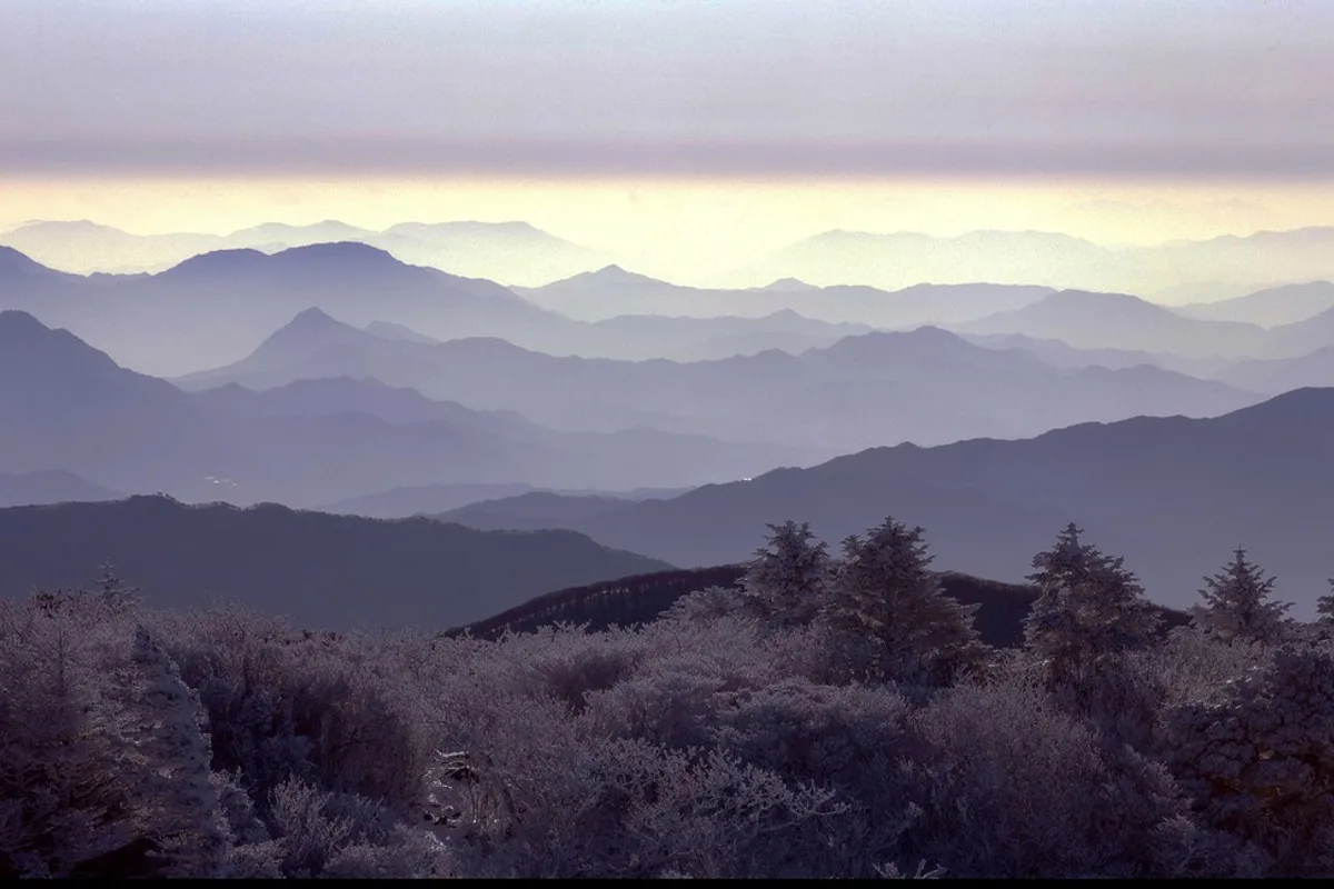
In winter, the mountain transforms. Rime flowers — ice crystals forming on branches at temperatures below -6°C with humidity above 90% — coat the summit ridge in white. It is the most photographed winter mountain scene in Korea.
Quick Info
Quick summary for planning your Deogyusan hike at a glance.
- Location: Muju-gun, Jeollabuk-do / Geochang-gun / Hamyang-gun, Gyeongsangnam-do, South Korea
- Highest Peak: Hyangjeokbong, 1,614m (4th highest in South Korea)
- Park Area: 219 km²
- Difficulty: Easy (gondola) to Hard (ridge traverse)
- Best Time to Visit: December–February (rime flowers), October (autumn foliage), June (azaleas)
- Entrance Fee: Free (gondola separate)
- Park Designation: National Park since 1975
- Travel Time from Seoul: ~3 hours by car
Trail Overview
| Trail | Distance | Elevation Gain | Time | Difficulty | Best For |
|---|---|---|---|---|---|
| Gondola + Summit Walk | 1.3km one-way | +94m | 1.5h round trip | Easy | Anyone, winter rime, families |
| Gucheondong–Baeryeonsa–Summit | 8.9km one-way | +700m | 4–4.5h up | Moderate | Valley scenery, temple, classic route |
| Ridge Traverse (Hyangjeokbong–Namdeogyusan) | 15+km | +1,000m | 6–8h | Hard | Full ridge, experienced hikers |
Why Deogyusan Is Worth the Trip
Deogyusan does something no other major Korean mountain does: it lets you reach 1,614 meters without hiking. The gondola from Muju Resort to Seolcheonbong eliminates 1,400 meters of climbing, leaving a 1.3-kilometer walk to the summit on a well-maintained path. For visitors who want to stand on one of Korea's highest peaks — higher than Seoraksan's Ulsanbawi, higher than anything in the Seoul region — but cannot commit to a full-day mountain hike, this is the answer.
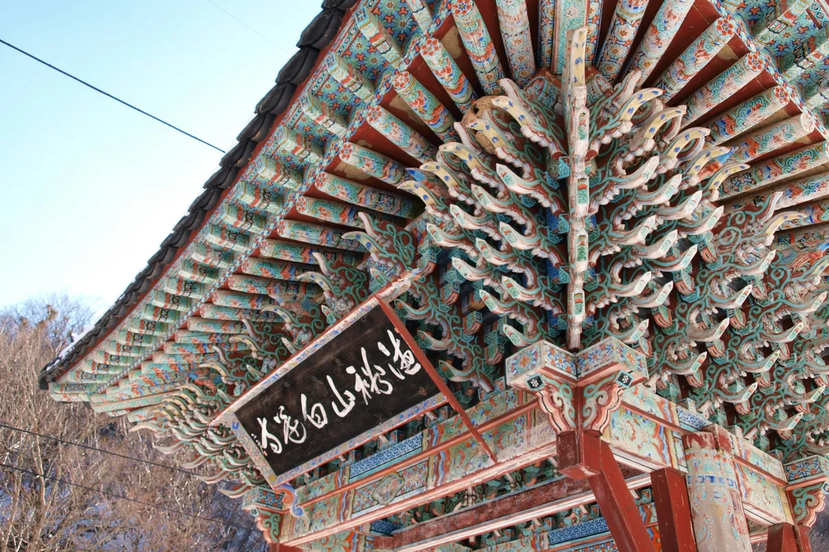
For those who can, the Gucheondong valley approach delivers what the gondola skips. The 33 scenic spots along the valley — pools named for dragons and lions, waterfalls named for moons and lotus flowers — have been catalogued and celebrated in Korean literature for centuries. The inner valley, accessible only on foot, passes through primordial forest before reaching Baeryeonsa Temple at 900 meters — one of the highest-elevation temples in Korea, founded during Unified Silla by a monk who saw white lotus flowers rising from the ground where he meditated.
The ecology at summit elevation is distinctive. Korean fir (구상나무) — endemic to South Korea and threatened by climate change — grows in communities of roughly 3,000 trees across the upper slopes. Many of these trees are already in decline due to rising temperatures. Yew (주목) stands share the high ground. In spring, azalea blooms cover the ridge. In winter, the combination of cold temperature and high humidity from the Geum River valley below produces the rime flowers that define Deogyusan's visual identity.
For comparison, Seoraksan offers more dramatic granite but lower elevation. Songnisan has UNESCO temple heritage but a less dramatic summit. Deogyusan's combination — gondola access to 1,600 meters, a 36-kilometer valley system, and winter rime — has no direct equivalent among Korean national parks.
Difficulty and Time Required
The gondola route requires almost no fitness. The 1.3-kilometer walk from Seolcheonbong to Hyangjeokbong is gentle, well-maintained, and takes roughly 30 minutes each way. In winter, the path may be icy — crampons are recommended but the distance is short enough that most visitors manage.
The Gucheondong valley route is a proper mountain hike. The 8.9 kilometers from the visitor center to Hyangjeokbong gain 700 meters through valley floor, temple grounds, and increasingly steep forest. The final section from Baeryeonsa to the summit is sustained climbing — roughly 1.5 hours of steady effort with no flat sections. Allow 4 to 4.5 hours ascending, 3 hours descending.
The ridge traverse from Hyangjeokbong to Namdeogyusan is a full-day commitment for experienced hikers. The 15-plus kilometer route maintains 1,300-meter elevation across exposed alpine ridge with limited shelter and water. Once you commit to the ridge, turning back is not always straightforward. Mountain shelters at Hyangjeokbong and Satgatjae require advance reservation.
Trail Options
Gondola + Summit Walk — Easiest Option
The Muju Resort gondola lifts you from the base to Seolcheonbong at 1,520 meters in roughly 15 minutes. From the upper station, a 1.3-kilometer trail leads to Hyangjeokbong summit at 1,614 meters. The path is wide and well-maintained. Round trip from the gondola station takes approximately 90 minutes including time at the summit.
In winter, this is the primary way most visitors experience Deogyusan's rime flowers. The ice crystals form when temperatures drop below -6°C and humidity exceeds 90% — conditions that occur regularly on the summit ridge from December through February. The frosted branches against a clear sky are the defining image of Korean winter mountains. On peak winter weekends, expect long lines for the gondola.
Best for: Non-hikers, families, winter rime photography, anyone wanting a 1,600-meter summit without the climb.
Gucheondong–Baeryeonsa–Summit — Classic Route
The standard Deogyusan hiking experience. From the Muju Gucheondong Visitor Center, the trail follows the valley through the inner scenic spots, passes Baeryeonsa Temple, and climbs to Hyangjeokbong.
Lower section — Visitor center to inner valley (3km, 1h)
The trail enters the Gucheondong gorge system. The outer 14 scenic spots are accessible by road, but the inner valley — spots 15 through 32 — requires walking. Waterfalls, pools, and named rock formations appear in sequence. The water is clear, cold, and runs through forest that has not been commercially logged. The scenery changes often enough that the long distance never feels repetitive.
Mid section — Valley to Baeryeonsa Temple (3km, 1.5h)
The gradient increases through old-growth forest. Baeryeonsa Temple sits at roughly 900 meters — one of Korea's highest-elevation temples, originally founded during Unified Silla. The current buildings are post-Korean War reconstructions. The temple marks the transition from valley hiking to summit climbing.
Upper section — Baeryeonsa to Hyangjeokbong (2.9km, 2h)
The steepest section. The trail climbs through Korean fir and yew communities — the endemic alpine vegetation that makes Deogyusan ecologically significant. The forest thins near the summit ridge. Jungbong (1,594m) appears as a false summit before the final push to Hyangjeokbong at 1,614 meters.
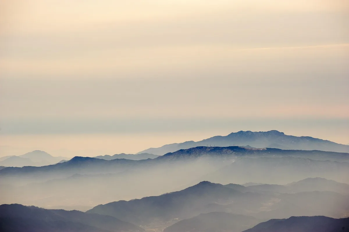
From the top, the view extends across the Sobaek mountain range in every direction. On clear days, the ridgeline stretching southwest toward Namdeogyusan is visible in its full 17-kilometer length.
Round trip: approximately 7 to 8 hours including stops.
Best for: Experienced hikers wanting the full Deogyusan experience, valley and temple scenery, alpine ecology.
Ridge Traverse — Advanced Route
The full ridge from Hyangjeokbong to Namdeogyusan covers 15-plus kilometers at an average elevation of 1,300 meters. The traverse passes through exposed alpine terrain with Korean fir communities, azalea fields, and views across both Jeolla and Gyeongsang provinces. Allow 6 to 8 hours.
Mountain shelters are available but limited:
- Hyangjeokbong Shelter: 5,000 KRW, limited capacity, reservation required
- Satgatjae Shelter: 8,000 KRW, approximately 45 people, reservation opens on the 1st and 15th of each month
Water is scarce on the ridge. Carry at least 3 liters and fill up at Baeryeonsa or the Anseong crossroads spring before committing to the traverse.
Best for: Experienced hikers with full gear, those wanting the complete Deogyusan ridge experience.
Best for Most Travelers
If you have limited time or fitness: the gondola + summit walk. Ninety minutes round trip, 1,614 meters, no climbing required. In winter, this is the best way to see the rime flowers.
If you have a full day: the Gucheondong–Baeryeonsa–summit route. The 33 scenic spots, the temple at 900 meters, and the summit ridge give you the complete Deogyusan experience in 7 to 8 hours round trip.
If you are not sure: take the gondola. You can always return for the valley another time.
Who Should Do This Hike
Deogyusan is the rare Korean mountain that works for everyone. The gondola puts a 1,614-meter summit within reach of any visitor — no gear, no fitness, no preparation beyond warm clothing in winter. The Gucheondong valley route is a proper half-day to full-day hike through one of Korea's finest gorge landscapes. And the ridge traverse is a serious mountain day for experienced hikers. You don't often get this range of options on a single mountain in Korea.
The winter rime flowers are the single best reason to visit Deogyusan over any other Korean mountain between December and February. The gondola makes them accessible to anyone willing to dress warmly.
Bear warning signs are posted in some areas of the park — Asiatic black bears have been documented in the Deogyusan region. Follow posted guidelines: make noise on the trail, do not leave food unattended, and retreat slowly if you encounter wildlife.
Tips Before You Go
- The gondola operates year-round but may close during high winds or severe weather. Check Muju Resort's schedule before planning a winter visit.
- Bring at least 2 liters of water for the Gucheondong route, 3 liters for the ridge traverse. Water sources on the ridge are limited and seasonal.
- Seasonal trail closures apply: spring (typically early March to mid-May) and autumn (typically mid-November to mid-December) for fire prevention. Check the Korea National Park Service website before visiting.
- Mountain shelter reservations open on the 1st and 15th of each month. Book well in advance during peak seasons.
- In winter, crampons and full cold-weather gear are essential. Summit temperatures drop to -10°C to -20°C with strong ridge winds.
- Rime flowers form at temperatures below -6°C with humidity above 90%. Check weather conditions the morning of your visit — the phenomenon is not guaranteed.
- Emergency number: 119.
How to Get There
From Seoul (car or express bus): Drive approximately 230km via Tonggyeong-Daejeon Expressway, roughly 3 hours. Express buses from Seoul to Muju run regularly, journey time approximately 3 hours. From Muju town, take a local bus or taxi to the Gucheondong Visitor Center or Muju Resort (approximately 30 minutes).
Gondola access: The Muju Resort gondola is located at the resort base area. Operating hours and pricing vary by season — check the resort website before visiting.
By train + bus: KTX to Daejeon (50 minutes), then express bus to Muju (approximately 1.5 hours). Total travel time roughly 3 hours.
Use Naver Maps for real-time transit directions on the day.
Final Thoughts
Deogyusan is the mountain where altitude is not a barrier. The gondola to 1,520 meters — and the short walk to 1,614 meters — puts one of Korea's highest summits within reach of anyone. But the mountain rewards those who take the longer way. The Gucheondong valley, with its 33 named pools and waterfalls running 36 kilometers from summit to plain, is one of the most structured natural landscapes in Korea. Each spot has a name, a story, and a view that justifies the walking.
In winter, the rime flowers on the summit ridge are worth the trip from Seoul on their own. In summer, the Korean fir communities on the upper slopes are a living reminder of what climate change threatens to take. And between the two seasons, the autumn foliage in the Gucheondong valley and the spring azaleas on the ridge give Deogyusan four distinct reasons to visit. It's one of the few mountains in Korea where how you choose to hike matters as much as where you go.
For the best hikes reachable directly from Seoul by subway, see the full Seoul hiking guide.
Related Guides
Explore more hiking in Korea:
- Best hikes in Seoul — full overview of Seoul's mountains by subway
- Seoraksan Hiking Guide — Korea's top hiking destination
- Songnisan Hiking Guide — UNESCO temple and granite ridge
- Palgongsan Hiking Guide — Gatbawi Buddha near Daegu
FAQ
How difficult is Deogyusan with the gondola? Very easy. The gondola carries you to 1,520 meters, and the remaining 1.3-kilometer walk to Hyangjeokbong summit at 1,614 meters is gentle and well-maintained. Round trip from the gondola station takes approximately 90 minutes. In winter, crampons are recommended for icy sections.
How do I get to Deogyusan from Seoul? Drive approximately 3 hours via expressway, or take KTX to Daejeon (50 minutes) then an express bus to Muju (1.5 hours). From Muju, a local bus or taxi reaches the trailhead or resort in approximately 30 minutes.
When is the best time to see rime flowers on Deogyusan? December through February, when temperatures drop below -6°C and humidity exceeds 90%. The phenomenon is weather-dependent and not guaranteed on any given day. Check conditions the morning of your visit. The gondola provides the easiest access to the summit ridge where rime flowers form.
What is the Gucheondong valley? A 36-kilometer gorge system with 33 named scenic spots — waterfalls, pools, and rock formations — running from the summit to the plains. The outer 14 spots are accessible by road. The inner 19 spots require hiking through the valley.
Are there mountain shelters on Deogyusan? Yes. Hyangjeokbong Shelter (5,000 KRW) and Satgatjae Shelter (8,000 KRW, 45-person capacity) are available on the ridge. Reservations open on the 1st and 15th of each month and must be booked in advance.
What should I bring for hiking Deogyusan? For the gondola route: warm clothing in winter, comfortable shoes. For the Gucheondong route: hiking boots, 2 liters of water, rain protection. For the ridge traverse: full hiking gear, 3 liters of water, headlamp, and food. In winter, crampons and insulated layers are essential at all elevations above 1,000 meters.
Continue exploring Korea's mountains
More routes, same honest field notes.
Related guides

Same region
EasyByeonsanbando Hiking Guide: Sea Cliffs and Naesosa
A practical guide to hiking Byeonsanbando — Korea's only peninsular national park, with Chaeseokgang UNESCO sea cliffs, Jikso Falls, and Naesosa fir forest.

Same region
ModerateMudeungsan Hiking Guide: Columnar Joints and Trails
A practical guide to hiking Mudeungsan National Park in Gwangju — the Jeungsimsa trail, Seoseokdae columnar joints, UNESCO Geopark status, and Seoul access.

Same region
ModerateNaejangsan Hiking Guide: Korea's Best Autumn Foliage
A practical guide to hiking Naejangsan National Park — Korea's premier autumn foliage destination with the Danpung Tunnel, Sinseonbong summit, and KTX access.