Hallasan Hiking Guide: Baengnokdam Summit on Jeju
A practical guide to hiking Hallasan on Jeju Island — South Korea's highest peak at 1,947m, the Seongpanak and Gwaneumsa summit trails, and permit reservations.

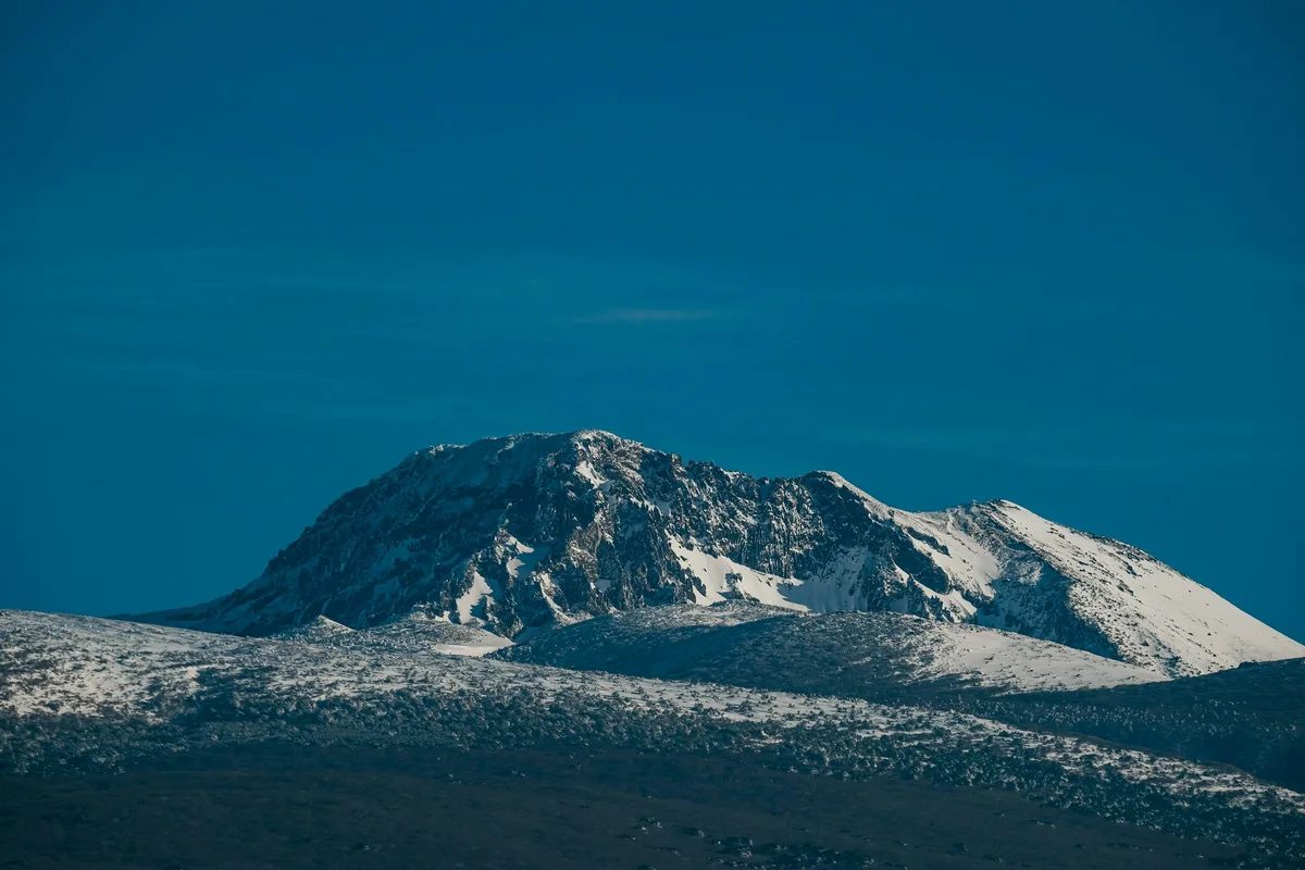
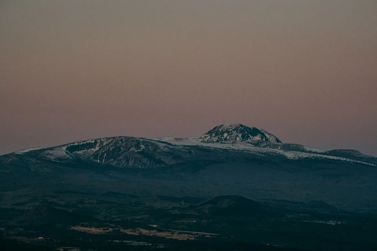
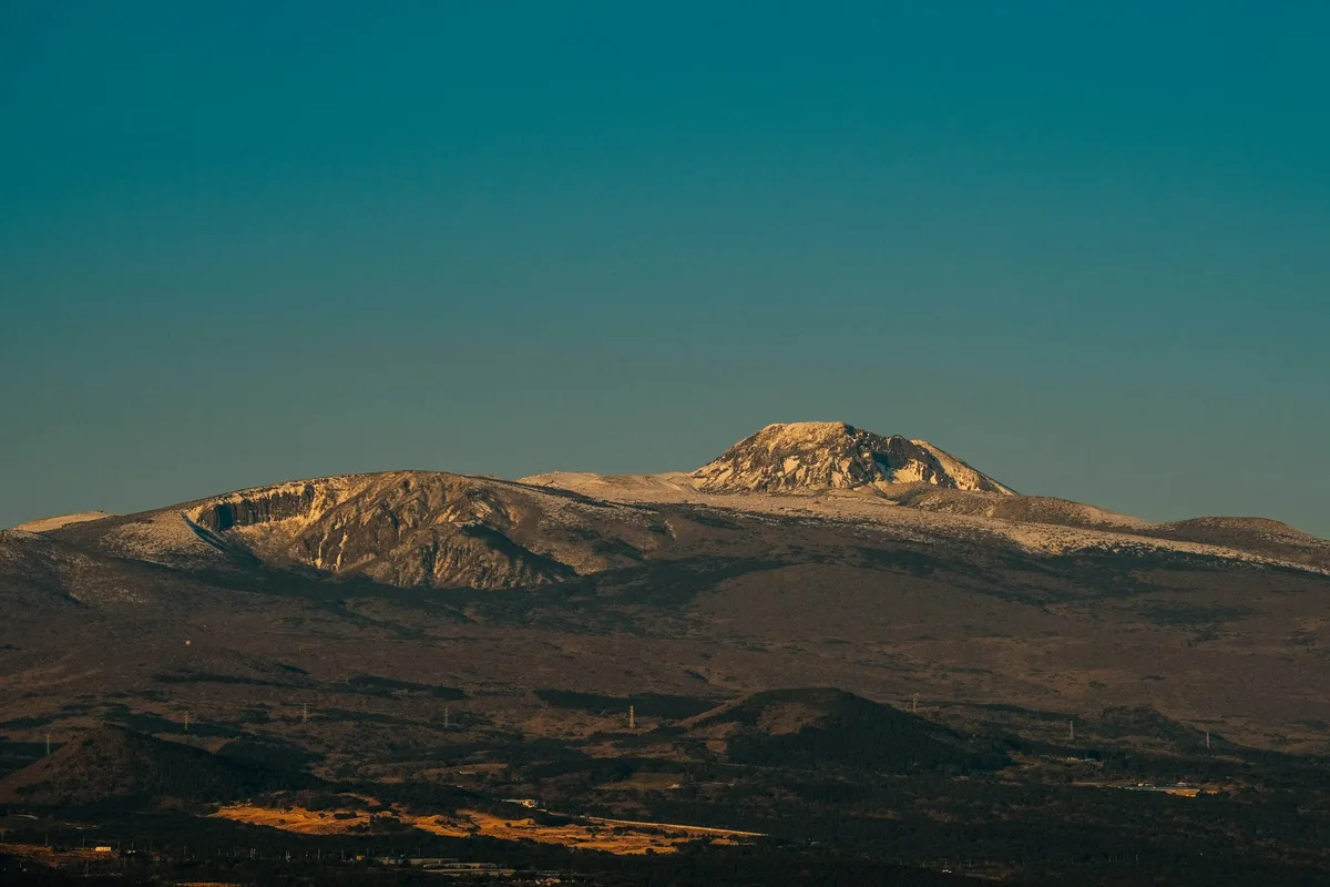
Hallasan is South Korea's highest mountain. At 1,947 meters, it stands above every peak on the mainland — including Jirisan's Cheonwangbong at 1,915 meters — and occupies roughly five percent of Jeju Island. The name means "mountain high enough to pull down the Milky Way," and the island was built around it: Jeju itself is a shield volcano, and Hallasan is its summit.
The mountain holds a distinction no other Korean peak can claim: the UNESCO triple crown. It was inscribed as a Biosphere Reserve in 2002, a World Natural Heritage site in 2007, and a Global Geopark in 2010. Only a handful of sites worldwide hold all three designations, and Hallasan is the only one in Korea.
At the summit is Baengnokdam — "White Deer Lake" — a 2-kilometer-circumference crater lake 100 meters deep, the only natural lake on Jeju Island and the single most photographed view in Korean hiking. Getting there requires a permit, a pre-dawn start, and either the 9.7-kilometer Seongpanak trail or the 8.7-kilometer Gwaneumsa trail. Rangers enforce a strict turnaround system, and missing the cutoff gets you a three-month booking ban.
Around the volcano sit roughly 360 parasitic cones — the oreum that define Jeju's landscape — plus lava tube systems, endemic Korean fir forests listed as endangered by the IUCN, and the cultural weight of a mountain central to both the Seolmundae Halmang creation myth and the Jeju 4.3 uprising.
Quick Info
Quick summary for planning your Hallasan hike at a glance.
- Location: Jeju Island (Jeju-si / Seogwipo-si boundary), South Korea
- Highest Peak: Baengnokdam summit, 1,947m (South Korea's highest, including Jeju)
- Park Area: ~153 km² (approximately 5% of Jeju Island)
- Volcano Type: Shield volcano; last eruption ~1007 CE (Goryeo-era record)
- UNESCO Status: Triple crown — Biosphere Reserve (2002), World Natural Heritage (2007), Global Geopark (2010)
- Difficulty: Moderate (Seongpanak, Yeongsil) to Strenuous (Gwaneumsa)
- Summit Permit: Required for Seongpanak and Gwaneumsa (free, advance reservation)
- Best Time to Visit: Late May–early June (azalea), October (foliage and clear skies)
- Entrance Fee: Free
- Park Hours: Gates open ~05:00; summit entry closes 14:00 (Apr–Sep) / 12:00 (Oct–Mar)
Trail Overview
| Trail | Distance | Elevation Gain | Time | Difficulty | Summit Access |
|---|---|---|---|---|---|
| Seongpanak | 9.7km one-way | +1,100m | 6–8h | Moderate | Yes (permit required) |
| Gwaneumsa | 8.7km one-way | +1,250m | 8–9h | Strenuous | Yes (permit required) |
| Yeongsil | 5.8km | varies | 2.5–3h | Moderate | No (stops at ~1,700m) |
| Eorimok | ~6km | varies | 3–4h | Moderate | No (stops at ~1,700m) |
| Donnaeko | 9km | varies | 4–5h | Moderate–Strenuous | No (stops at ~1,600m) |
| Seongpanak ↑ / Gwaneumsa ↓ | 18.4km | +1,100m / –1,250m | 10–11h | Strenuous | Yes (recommended combo) |
Why Hallasan Is a Category of Its Own
Every other mountain in this guide is on the mainland. Hallasan is not. It is a shield volcano rising from the Pacific, 450 kilometers south of Seoul, and the entire island it sits on was formed by its own eruptions. Jeju is Hallasan.
That single geological fact changes the hiking experience. The vertical ecosystem spans from subtropical evergreen broadleaf forest at sea level to subarctic alpine vegetation at the summit — the full climatic range of the Korean peninsula compressed into a single 1,947-meter climb. The 360 parasitic cones, or oreum, scattered across the island are the surface expression of the same volcanic system. The lava tubes — including Manjanggul and Benddugul, the latter at roughly 8.8 kilometers Korea's longest — are inscribed as part of the UNESCO heritage site.
The cultural layer is equally distinctive. In Jeju mythology, Seolmundae Halmang — a grandmother goddess of immense size — created the island by carrying earth in her skirt; Hallasan is the last mound she set down, and the 500 Generals rock formation on the Yeongsil trail is said to be her sons, frozen in stone. This is not decorative folklore. It is the foundational cosmology of Jeju, still invoked at shamanic rituals today.
The modern history is heavier. The Jeju 4.3 uprising of 1948–1954 left Hallasan as the last refuge of armed resistance and produced a death toll estimated at 14,000 to 30,000 — roughly a tenth of Jeju's population at the time. The 4.3 archives were inscribed by UNESCO as Memory of the World in April 2025. Hiking Hallasan crosses that history whether you know it or not.
For a mainland comparison point: Jirisan is Korea's highest mainland summit and offers a multi-day ridge traverse, but no UNESCO natural heritage status and no crater lake. Seoraksan has more dramatic granite scenery but lower elevation. Bukhansan is closer to Seoul but a fraction of the scale. Hallasan is the only Korean mountain where a day hike takes you from subtropical forest to the rim of a crater lake on a UNESCO World Heritage volcano.
Difficulty and Time Required
Hallasan is moderate on paper and demanding in practice. The gap between "reaching the summit" and "completing the full hike" is significant, and the weather can collapse that gap further.
Seongpanak — the easier of the two summit routes — covers 9.7 kilometers with 1,100 meters of elevation gain. Most hikers in reasonable fitness finish the round trip in 8 to 10 hours including summit time. The grade is gentle for the first half and progressively steeper through the 1,100m wetland and the final ridge.
Gwaneumsa — the harder route — is shorter at 8.7 kilometers but steeper, with 1,250 meters of elevation gain and sustained climbing from the start. Most hikers allow 10 to 12 hours round trip. This is not a beginner's trail.
The two non-summit options — Yeongsil and Eorimok — are different hikes entirely. Both reach around 1,700 meters at Witse Oreum shelter but stop there; neither connects to the summit. Yeongsil (5.8 kilometers, 2.5 to 3 hours) is the single best short hike on the mountain, and during late May and early June the lower slopes are covered in royal azalea.
Weather is the defining variable. The summit averages 6°C colder than the base, sudden fog and lightning are common from late morning onward, and rangers routinely close summit routes for wind, snow, or electrical storms. The mandatory morning start is not bureaucratic — it is a safety margin.
Trail Options
Seongpanak Trail — Most Popular Summit Route
Seongpanak is the standard summit approach: 9.7 kilometers one-way from the Seongpanak Visitor Center at 750m elevation to Baengnokdam at 1,947m. The trail climbs gradually through evergreen broadleaf forest, transitions through conifer belt, crosses the 1,100m wetland on boardwalk, and ends on an exposed alpine ridge in the final kilometer.
The path is well-maintained. Long sections are wooden stairs and boardwalk, which are secure in dry weather but genuinely slippery when wet. There are two shelters along the way — at roughly the 4.5-kilometer mark and at the 1,100m wetland around 7 kilometers — with basic pit toilets and intermittent water.
Daily cap: 800 hikers per day, allocated by reservation.
Permit: Free, booked through the Hallasan National Park reservation system. Passport or Korean ID is checked at the entry gate.
Timing: Gates open around 05:00. To reach the summit and return on schedule, most hikers pass the checkpoint between 05:30 and 07:30. The summit entry cutoff at Jindallaebat checkpoint is 14:00 from April to September and 12:00 from October to March — if you miss it, rangers will turn you back.
Best for: First-time Hallasan visitors, hikers in moderate fitness, anyone attempting the summit without technical experience.
Gwaneumsa Trail — Harder Summit Route
The Gwaneumsa trail is shorter (8.7 kilometers) but meaningfully harder. The trailhead starts lower at 620 meters, meaning more vertical for less distance, and the grade is sustained rather than graduated. Rock scramble sections between kilometers 3 and 5 require hand-over-hand movement in places, and the final ridge is fully exposed to wind.
The scenery is also better. Gwaneumsa passes through deeper forest, more dramatic volcanic terrain, and the Samgakbong (Triangle Peak) viewpoint on the approach to the summit. Fewer crowds — the daily cap is half that of Seongpanak.
Daily cap: 400 hikers per day.
Permit: Free, same reservation system. Same time cutoffs apply.
Recommended combination: Many experienced hikers ascend via Seongpanak (gentler on the legs with a fresh body) and descend via Gwaneumsa (steeper descent is faster, and the reverse order is hard on tired knees). The full 18.4-kilometer traverse takes 10 to 11 hours.
Best for: Experienced hikers, anyone who has done a 1,000m-gain day hike before, the ascend-Seongpanak / descend-Gwaneumsa combination.
Yeongsil Trail — Best Non-Summit Option
The Yeongsil trail is the shortest way to experience Hallasan's high country. At 5.8 kilometers and 2.5 to 3 hours, it climbs to the Witse Oreum area at approximately 1,700 meters, with a direct view of the summit cliffs across the valley and the 500 Generals rock formation — the volcanic column cluster tied to the Seolmundae Halmang myth.
It does not reach Baengnokdam. No summit trail connects from Witse Oreum to the top; the ridge is a protected closure zone. But for visitors with limited time, limited fitness, or no permit, Yeongsil is the best single hike on the mountain.
In late May through early June, royal azalea blooms across the Witse Oreum slopes. This is the most photographed non-summit scene on Hallasan.
Best for: Day-trippers, anyone without a summit permit, azalea season, hikers with children.
Eorimok Trail — Quiet Forest Alternative
Eorimok follows a similar concept to Yeongsil — 6 kilometers to the Witse Oreum shelter, 3 to 4 hours — but through a more heavily forested route. The views are less dramatic, but the walk is quieter and the forest canopy provides shade throughout the ascent.
Many hikers pair Eorimok with Yeongsil for a loop: up Eorimok, across the Witse Oreum plateau, down Yeongsil (or vice versa). The two trailheads are separated by road, so you will need transportation from one to the other at the end.
Best for: Forest walking, quieter hiking, Eorimok–Yeongsil loop combinations.
Donnaeko Trail — Southern Approach
Donnaeko is the southern approach — 9 kilometers, 4 to 5 hours, reaching around 1,600 meters at Donnaeko shelter. It is the least crowded of the five routes. The scenery is forested and the gradient is steady, but without a summit payoff or a standout view, most international visitors skip it.
Best for: Hikers wanting solitude, the southern Seogwipo approach, experienced visitors who have already done the popular routes.
Best for Most Travelers
If you have one day on Jeju and don't have a permit: Yeongsil trail. Two-and-a-half to three hours, reaches 1,700 meters, views of the summit cliffs and the 500 Generals formation, azalea in late May and early June.
If you have one day and a summit permit: Seongpanak up, Seongpanak down (or Seongpanak up, Gwaneumsa down if you are fit and have transportation). Start at the gate opening, budget 8 to 11 hours, and bring more water than you think.
If you are not sure you can finish a summit attempt: start with Yeongsil. There is no shame in not summiting Hallasan — the weather, the permit system, and the turnaround cutoffs mean a significant number of attempts fail for reasons outside the hiker's control.
Who Should Do This Hike
Hallasan accommodates a wider range of visitors than it first appears. The summit routes are not technical — no ropes, no exposure beyond an alpine ridge — but the distance, elevation gain, and weather exposure put them squarely in the "full-day serious hike" category. You need to be comfortable walking for 8 to 10 hours with elevation, carrying 3 liters of water, and turning back if conditions deteriorate.
The Yeongsil and Eorimok trails are accessible to most adults in reasonable fitness with proper footwear. They do not require permits and do not involve exposed ridge sections.
Hallasan is not a good first mountain in Korea. If you have not hiked Bukhansan or Seoraksan's Ulsanbawi, consider starting there. The permit system, the turnaround enforcement, the weather variability, and the distance from a major city make Hallasan unforgiving for unprepared hikers.
Winter ascents require crampons, wind-resistant gear, and experience with snow hiking. Summit routes may close entirely for snow accumulation above 50 centimeters.
Tips Before You Go
- Book the permit in advance. Seongpanak and Gwaneumsa both require free permits through the Hallasan National Park reservation system. Popular dates (weekends, autumn, cherry blossom season) fill fast. Reservations open on the 1st of each month for dates through the end of the following month.
- Bring your passport. Rangers check ID at the entry gate. Screenshot the QR code confirmation and bring a printed backup.
- Start early. The summit entry cutoff is 14:00 April–September, 12:00 October–March. You must pass the checkpoint by that time — not start your hike, not park your car. Missing the cutoff triggers a three-month booking ban (12 months on the second offense).
- Carry 3 liters of water minimum. Shelters have intermittent water at best. In summer, carry 4 liters.
- Layer for 20°C temperature swings. The summit is roughly 6°C colder than the base, and wind at the ridge can strip another 5 to 10 degrees of effective warmth. A windproof shell is essential even on clear summer days.
- Do not eat or drink at Baengnokdam. It is the only natural freshwater lake on Jeju and the watershed for the region. Waste of any kind is prohibited at the crater rim.
- Weather closes the summit routes frequently. Check the Hallasan National Park website the evening before and the morning of. Closures for wind, snow, or electrical storms are decided by ranger discretion and can change within hours.
- Korean fir forests are dying. Roughly 1,300 to 1,900 meters, the endemic Abies koreana stands you pass through are listed as Endangered by the IUCN. Stay on the path. Off-trail hiking carries fines up to 500,000 KRW.
- Emergency numbers: 112 (general emergency), 1339 (mountain rescue), 1330 (tourist hotline, English support).
How to Get There
Getting to Jeju: From Seoul (Gimpo or Incheon) to Jeju International Airport, flights are approximately 1 hour 5 minutes and depart every 15 to 30 minutes during the day. Jeju is also accessible by ferry from Wando, Mokpo, and several other mainland ports.
From Jeju International Airport to trailheads:
- Seongpanak trailhead: Bus 281 (express) or Bus 181 from Jeju city to Seongpanak, approximately 40 minutes. Taxi approximately 25 to 35 minutes depending on traffic.
- Gwaneumsa trailhead: No direct bus. Taxi from Jeju city, approximately 20 to 30 minutes. If hiking Seongpanak-up / Gwaneumsa-down, arrange return transport in advance.
- Yeongsil trailhead: Bus 240 from Jeju or Seogwipo to the 1100 Highway rest area, then short walk or shuttle (seasonal).
- Eorimok trailhead: Same Bus 240; check current schedule.
- Donnaeko trailhead: Bus service from Seogwipo; taxi is faster.
Use Naver Maps or Kakao Map for real-time transit directions on the day — bus schedules around the 1100 Highway vary seasonally.
Driving: All five trailheads have parking. Expect full lots on weekends and during the azalea and foliage peaks; arriving before 06:00 is the safest strategy.
Final Thoughts
Hallasan is the most structurally distinctive hike in Korea. A single volcano forms an entire island, a crater lake sits at the summit, and the permit system forces every hiker onto the same early-morning schedule. UNESCO has recognized the site three times for three different reasons — biosphere, natural heritage, geopark — and there is no equivalent mountain anywhere else in the country.
If you want the summit view, commit to the logistics. Book the permit two to four weeks in advance, fly to Jeju the day before, be at the Seongpanak gate at 05:00, and budget the full day. The Baengnokdam crater rim — a 100-meter-deep lake ringed by volcanic rock, the Pacific visible to the south on clear days — is worth it.
If you can only do one short hike on Jeju, the Yeongsil trail delivers the mountain's scale in 3 hours. And if you are planning a broader Korea hiking itinerary, Hallasan pairs well with Jirisan as the two summit objectives — the highest peak on the mainland, and the highest peak in the country.
For hikes reachable directly from Seoul by subway, see the full Seoul hiking guide.
Related Guides
Explore more hiking in Korea:
- Jirisan Hiking Guide — mainland South Korea's highest mountain and Korea's first national park
- Seoraksan Hiking Guide — the most famous granite peaks on the mainland
- Best hikes in Seoul — Seoul's mountains by subway
- Bukhansan Baegundae Hiking Guide — a good mainland warm-up before Hallasan
FAQ
Do I need a permit to hike Hallasan? Yes, for the two summit trails — Seongpanak and Gwaneumsa. Permits are free but must be booked in advance through the Hallasan National Park reservation system, and your passport is checked at the entry gate. The three non-summit trails (Yeongsil, Eorimok, Donnaeko) do not require permits.
Which Hallasan trail should I choose? Seongpanak is the standard summit approach — longer but gentler, suitable for most fit hikers. Gwaneumsa is shorter but steeper and more scenic, best for experienced hikers. Yeongsil is the best non-summit option at 2.5 to 3 hours and reaches 1,700 meters with direct views of the summit cliffs.
How long does it take to hike Hallasan? Seongpanak round trip takes 8 to 10 hours for most hikers. Gwaneumsa round trip takes 10 to 12 hours. The Seongpanak-up / Gwaneumsa-down combination takes 10 to 11 hours across 18.4 kilometers. Yeongsil and Eorimok are 3 to 4 hours each.
What is the best time to hike Hallasan? Late May through early June for royal azalea on the Yeongsil slopes. October for clear skies, autumn foliage, and the most reliable summit weather. Summer is often cloudy and humid; winter closes routes for snow and wind.
Can I see Baengnokdam without a permit? No. The crater lake is only visible from the summit, and the summit is only reachable via the two permit-required trails (Seongpanak and Gwaneumsa). The non-summit trails stop at around 1,700 meters without a view of the lake.
Is Hallasan harder than Jirisan or Seoraksan? Comparable in difficulty but logistically stricter. The permit system, the hard turnaround cutoffs, and the distance from the mainland make Hallasan less forgiving for unprepared hikers. Fitness required is similar to the Jirisan Cheonwangbong day hike or a full Seoraksan Daecheongbong ascent.
Continue exploring Korea's mountains
More routes, same honest field notes.
Related guides

Similar hike
HardGayasan Hiking Guide: Haeinsa and Tripitaka Koreana
A practical guide to hiking Gayasan National Park — the Haeinsa Temple route to Chilbulbong, the Manmulsang scramble, and UNESCO Tripitaka Koreana woodblocks.

Similar hike
ModerateSobaeksan Hiking Guide: Royal Azaleas and Ridges
A practical guide to hiking Sobaeksan National Park — Korea's alpine meadow ridge with Birobong royal azaleas, and flanking UNESCO sites Buseoksa and Sosuseowon.

Similar hike
ModerateSongnisan Hiking Guide: Beopjusa and Munjangdae
A practical guide to hiking Songnisan National Park — the Cheonhwangbong summit loop, UNESCO-listed Beopjusa Temple, the 33m Bronze Buddha, and Seoul access.