Gayasan Hiking Guide: Haeinsa and Tripitaka Koreana
A practical guide to hiking Gayasan National Park — the Haeinsa Temple route to Chilbulbong, the Manmulsang scramble, and UNESCO Tripitaka Koreana woodblocks.

Gayasan rises to 1,433 meters at the border of North and South Gyeongsang provinces — roughly 4 hours from Seoul by car or KTX and bus. The mountain is named after Bodh Gaya in India, where the Buddha attained enlightenment. The two summit peaks — Chilbulbong (1,433m) and Sangwangbong (1,430m), separated by just 3 meters of height — are said to resemble the head of an ox, and the mountain carries a second name: Udubong, "Ox Head Peak."
None of that is why most people come. They come for what sits at the base.
Haeinsa Temple, founded in 802 CE, holds the Tripitaka Koreana — 81,258 woodblock printing plates carved between 1237 and 1248 during the Goryeo Dynasty. It is the most complete and accurate version of the Buddhist canon in existence. The woodblocks are a UNESCO Memory of the World (2007). The Janggyeong Panjeon halls that house them — designed in the 15th century with an ingenious natural ventilation system that has preserved the blocks for over 760 years — are a UNESCO World Heritage Site (1995). Gayasan is one of the only places in the world where a single cultural complex holds both designations.
The hiking connects these layers. The Haeinsa route follows the Hongnyudong Valley — named "Red Flow Valley" because the autumn maples reflect so intensely in the water that the stream appears to run red — through 19 scenic points to the summit ridge. The Manmulsang course on the eastern flank is a reservation-only scrambling route through angular rock formations that represents some of the most technical terrain in the Korean national park system.
Quick Info
Quick summary for planning your Gayasan hike at a glance.
- Location: Hapcheon-gun / Seongju-gun / Geochang-gun, Gyeongsang Province, South Korea
- Highest Peak: Chilbulbong, 1,433m
- Park Area: 123 km²
- Difficulty: Easy (Sound Trail) to Hard (Manmulsang scramble)
- Best Time to Visit: October–November (autumn maples in Hongnyudong), April–May (spring)
- Entrance Fee: Free
- Park Designation: 9th National Park (1972)
- UNESCO: World Heritage (1995) + Memory of the World (2007)
- Travel Time from Seoul: ~4 hours by KTX + bus
Trail Overview
| Trail | Distance | Elevation Gain | Time | Difficulty | Best For |
|---|---|---|---|---|---|
| Haeinsa–Chilbulbong | 5–6km one-way | +700m | 4–5h up | Moderate | Temple, valley, summit |
| Baegundong Valley | 7–9km one-way | +800m | 5–7h up | Moderate–Hard | Solitude, granite valley |
| Manmulsang Course | 2.8km core | intense | 3–5h | Hard | Technical scrambling, rock formations |
| Yonggigol | varies | varies | 4–6h | Moderate–Hard | Valley scenery, fewer crowds |
| Gaya Sound Trail | 4km | minimal | 1.5–2h | Easy | Hongnyudong Valley, families |
Why Gayasan Is Worth the Trip
No other mountain in Korea offers what Gayasan does: a hike that begins at a double-UNESCO cultural complex and ends on a 1,433-meter summit. The Tripitaka Koreana at Haeinsa is not a replica or a museum piece — it is 81,258 original 13th-century woodblocks, still capable of producing clear prints after over 770 years, housed in purpose-built halls whose natural ventilation system has never been improved upon because it has never needed to be.
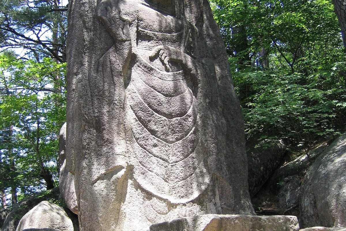
The trail from the temple to the summit follows the Hongnyudong Valley, where autumn maples reflect in the stream water and produce the red-tinted flow that gives the valley its name. The 9th-century scholar-official Choi Chi-won — one of the most celebrated intellectuals of the Silla Dynasty — carved calligraphy directly into the rock face along this valley. His inscription survives.
Above the valley, the geology splits. The upper mountain is anorthosite — Precambrian rock that forms angular, fractured peaks with hexagonal jointing patterns. The valleys below are granite — smoother, sculpted by water. The contrast produces Gayasan's distinctive silhouette: sharp peaks above, rounded valleys below.
The Manmulsang course on the eastern ridge takes this geology to its extreme. The name means "All Things Landscape" — a reference to the variety of shapes the angular rock formations take. The route requires a reservation, involves continuous scrambling with hands, and is the most technically demanding course in any Korean national park open to the general public.
For comparison, Songnisan has UNESCO temple heritage with a different architectural focus. Deogyusan offers higher elevation with gondola access. Gayasan's combination — double UNESCO designation, the Tripitaka Koreana, and technical ridge scrambling — exists nowhere else.
Difficulty and Time Required
Gayasan divides cleanly by difficulty. The Gaya Sound Trail along the Hongnyudong Valley is flat, scenic, and suitable for anyone. The Haeinsa-to-Chilbulbong route is a proper mountain hike — 700 meters of elevation gain through valley and ridge, 4 to 5 hours ascending — manageable for adults in good fitness with hiking boots.
The Manmulsang course is a different category. The 2.8-kilometer core section involves continuous scrambling on angular anorthosite with exposure, hand-climbing, and no flat rest sections. It requires a reservation, closes in poor weather, and is not appropriate for anyone uncomfortable with sustained technical terrain.
Wet rock on all upper routes is dangerous. The anorthosite surfaces become slippery when damp, and the angular formations offer fewer natural grip points than granite. Do not attempt the Manmulsang course after rain.
Trail Options
Haeinsa–Chilbulbong — Best Overall
The standard Gayasan experience. From the Haeinsa Temple entrance, the trail follows the Hongnyudong Valley upstream through 19 named scenic points before climbing to the summit ridge and Chilbulbong peak.
Temple complex — Haeinsa (allow 1h)
Haeinsa alone justifies the trip. The Janggyeong Panjeon halls — the 15th-century storage buildings for the Tripitaka Koreana — are the architectural highlight. The halls use irregularly sized windows on front and back walls, and floors packed with charcoal, lime, and salt to regulate temperature and humidity naturally. This system has kept 81,258 wooden printing blocks in near-perfect condition for over 760 years. The temple is one of Korea's three great monasteries, alongside Tongdosa and Songgwangsa.
Valley section — Hongnyudong (2.5km, 1.5h)
The trail follows the stream through granite valley. Nongsan Pavilion, Nakwha Pond, and Bunyok Waterfall mark the lower scenic points. Choi Chi-won's calligraphic inscription — carved directly into the rock during the late Silla period — is visible along this section. In October and November, the maple canopy reflects in the water, producing the red tint that gives the valley its name.
Upper section — Ridge to Chilbulbong (2.5km, 2.5h)
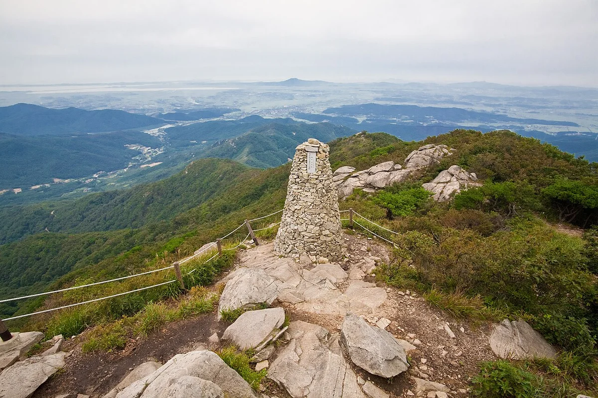
The trail steepens as it leaves the valley for the ridgeline. The rock transitions from granite to anorthosite — harder, more angular, with visible hexagonal jointing. The summit at 1,433 meters offers views across both Gyeongsang provinces. Sangwangbong (1,430m) is a short ridge walk away.
Round trip: approximately 8 to 9 hours including the temple visit.
Best for: First-time visitors, UNESCO heritage combined with summit hiking, autumn foliage.
Manmulsang Course — Technical Challenge
The most demanding route in the park. The 2.8-kilometer core section traverses angular anorthosite formations — hexagonal jointing, fractured ridgelines, and continuous exposure. Hands are required throughout. The route requires advance reservation through the Korea National Park Service.
Reservation system:
- Section: Manmulsang to Seoseong-jae (~3km)
- Operating period: March 1 to December 31
- Advance reservation required via the national park website
- Purpose: trail capacity management and ecosystem protection
The course closes in rain, snow, and ice. It is not appropriate for beginners.
Best for: Experienced hikers comfortable with Class 3 terrain, photography of rock formations.
Baegundong Valley — Quieter Alternative
The eastern approach from Baegundong Campground climbs through granite valley to the summit ridge. At 7 to 9 kilometers and 5 to 7 hours ascending, it is longer and less visited than the Haeinsa route. Facilities are limited to the campground at the base. The route offers more solitude and dramatic granite formations.
Best for: Experienced hikers, those seeking quieter trails, extended day hikes.
Gaya Sound Trail — Cultural Walk
A 4-kilometer trekking path following the Hongnyudong Valley from the upper mountain to the Haeinsa Temple entrance. Flat, accessible, and focused on the 19 scenic points along the valley. No summit hiking required. Best experienced in October and November when the autumn maples produce the "red flow" effect on the stream.
Best for: Families, cultural interest, non-hikers visiting Haeinsa, autumn foliage photography.
Who Should Do This Hike
Gayasan serves two audiences that rarely overlap: UNESCO heritage visitors and serious mountain hikers. The temple and the Sound Trail require no fitness and deliver one of the most significant cultural experiences available at any Korean national park. The Haeinsa-to-Chilbulbong route is a proper summit day. And the Manmulsang course is for experienced scramblers who want the hardest single-day route in the Korean national park system.
The autumn foliage in the Hongnyudong Valley — specifically the red reflection effect on the water — is worth timing a visit around. Peak color runs from early to mid-October through early November.
Best for Most Travelers
If you have a full day: the Haeinsa–Chilbulbong route. Start at the temple, walk the Hongnyudong Valley, and summit at 1,433 meters. Allow 8 to 9 hours including the temple visit.
If you have a half day or limited fitness: the Gaya Sound Trail. Four kilometers along the Hongnyudong Valley with the 19 scenic points and Haeinsa at the end. No summit required.
If you are a strong hiker looking for a challenge: add the Manmulsang course with advance reservation. It is the most technical terrain in any Korean national park open to the public.
Tips Before You Go
- Allow at least 1 hour for the Haeinsa Temple complex before starting the hike. The Janggyeong Panjeon halls and the Tripitaka Koreana are the primary reason most visitors come.
- Bring at least 2 liters of water for the Haeinsa route. Stream water is available in the valley but not on the upper ridge.
- The Manmulsang course requires advance reservation through the Korea National Park Service website. It closes during rain, snow, and ice conditions. Do not attempt it without scrambling experience.
- Wet anorthosite rock on the upper sections is dangerous. Avoid summit routes after rain.
- Autumn foliage in the Hongnyudong Valley peaks from early October to early November. Weekends during peak color draw heavy traffic.
- Hiking boots with ankle support are essential for the summit routes. The Sound Trail is walkable in any comfortable shoes.
- Emergency number: 119. Gayasan National Park office: 055-930-8000. Tourism hotline: 1330 (English available).
How to Get There
From Seoul (KTX + bus — recommended): Take KTX from Seoul to Dongdaegu Station (approximately 1 hour 40 minutes). From Dongdaegu, take an express bus to Hapcheon (approximately 1.5 hours). From Hapcheon, a local bus to Haeinsa Temple takes approximately 40 minutes. Total travel time is roughly 4 hours.
By car: Approximately 300km from Seoul via Gyeongbu Expressway and local roads, roughly 3.5 to 4 hours. Parking is available at the Haeinsa entrance area.
From Daegu: Express bus from Daegu to Hapcheon, then local bus to Haeinsa. Total approximately 2.5 hours.
Use Naver Maps for real-time transit directions on the day.
Final Thoughts
Gayasan is the mountain where the hike begins with the most important printed text in Korean Buddhist history and ends on a ridge named for seven Buddhas. The 81,258 woodblocks of the Tripitaka Koreana — carved in the 13th century, still printable today, housed in buildings whose ventilation system has worked for 760 years without modification — are not something you see on a screen. They occupy physical space in a mountain temple, and the trail from that temple to the summit passes through a valley that turns red in autumn.
The Manmulsang scramble adds another dimension for those who want it — angular rock, reservation-only access, and the most technical terrain in any Korean national park. But Gayasan does not require the summit to justify the visit. Haeinsa and the Hongnyudong Valley together are enough.
If you want UNESCO heritage and a real summit in one day, Gayasan is the best single destination in Korean hiking.
For the best hikes reachable directly from Seoul by subway, see the full Seoul hiking guide.
Related Guides
Explore more hiking in Korea:
- Best hikes in Seoul — full overview of Seoul's mountains by subway
- Seoraksan Hiking Guide — Korea's top hiking destination
- Songnisan Hiking Guide — UNESCO temple and granite ridge
- Deogyusan Hiking Guide — gondola summit and valley, nearby region
FAQ
How difficult is the Gayasan hike to Chilbulbong? The Haeinsa route is rated Moderate. The 5 to 6 kilometer ascent gains 700 meters through the Hongnyudong Valley and upper ridge. Allow 4 to 5 hours ascending. The Manmulsang course is rated Hard and requires advance reservation — it involves continuous hand-scrambling on angular rock with exposure.
What is the Tripitaka Koreana at Haeinsa? The Tripitaka Koreana is a collection of 81,258 woodblock printing plates carved between 1237 and 1248 during the Goryeo Dynasty. It is the most complete and accurate version of the Buddhist canon in existence — a UNESCO Memory of the World (2007). The halls housing them are a UNESCO World Heritage Site (1995).
How do I get to Gayasan from Seoul? Take KTX from Seoul to Dongdaegu (1 hour 40 minutes), express bus to Hapcheon (1.5 hours), then local bus to Haeinsa Temple (40 minutes). Total travel time is approximately 4 hours. By car, approximately 3.5 to 4 hours.
Do I need a reservation for the Manmulsang course? Yes. The Manmulsang to Seoseong-jae section (approximately 3 km) requires advance reservation through the Korea National Park Service website. The course operates from March 1 to December 31 and closes during rain, snow, and ice.
When is the best time to visit Gayasan? October to early November for the Hongnyudong Valley autumn foliage — the red maple reflection on the stream is the signature Gayasan experience. April to May for spring wildflowers. Summer is hot and humid at lower elevations.
Is Gayasan worth visiting? Yes. It is the only location in Korea where a UNESCO World Heritage temple, a UNESCO Memory of the World archive, and a full mountain summit hike are combined in a single day trip. The Hongnyudong Valley autumn foliage and the Manmulsang scramble add further depth.
Continue exploring Korea's mountains
More routes, same honest field notes.
Related guides

Nearby hikes
EasyJuwangsan Hiking Guide: Tuff Cliffs and Jusanji Pond
A practical guide to hiking Juwangsan National Park — a UNESCO Global Geopark with volcanic tuff cliffs, three valley waterfalls, and willow-lined Jusanji Pond.

Similar hike
ModerateSobaeksan Hiking Guide: Royal Azaleas and Ridges
A practical guide to hiking Sobaeksan National Park — Korea's alpine meadow ridge with Birobong royal azaleas, and flanking UNESCO sites Buseoksa and Sosuseowon.

Same region
ModeratePalgongsan Hiking Guide: Gatbawi Buddha and Summit
A practical guide to hiking Palgongsan National Park near Daegu — the Gatbawi stone Buddha pilgrimage, Donghwasa route to Birobong summit, and how to get there.