Mudeungsan Hiking Guide: Columnar Joints and Trails
A practical guide to hiking Mudeungsan National Park in Gwangju — the Jeungsimsa trail, Seoseokdae columnar joints, UNESCO Geopark status, and Seoul access.

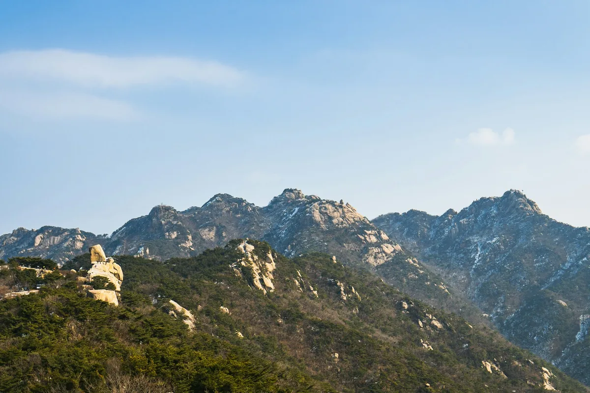
Mudeungsan rises to 1,187 meters above Gwangju, in southern South Korea — approximately 3 hours from Seoul by KTX. The mountain straddles the boundary between Gwangju Metropolitan City, Damyang, and Hwasun in South Jeolla Province. The name means "Peerless Mountain" — a mountain beyond ranking — and in Buddhist terminology, it signifies a state where equality is so fully realized that the concept of equality itself dissolves. The geology justifies the name. Near the summit, two massive formations of hexagonal columnar jointed rock stand exposed on the ridge: Seoseokdae and Ipseokdae, remnants of volcanic activity 84 to 87 million years ago. The columns are up to 9 meters wide — far larger than the basaltic columns found elsewhere in Korea — and earned the mountain UNESCO Global Geopark status in 2018.
The mountain has carried different names across different eras. In the Baekje period, it was Mujin-ak (武珍岳), recorded in the Samguk Sagi as a site where royal rites were performed — the character "珍" likely reflects the distinctive stone features already recognized at the time. During the Goryeo and Joseon periods, it became Seoseoksan (瑞石山), literally "Auspicious Stone Mountain," a direct reference to the columnar formations described in the Dongguk Yeoji Seungnam as "dozens of stone pillars standing on a sunny slope, each a hundred cheok tall." The current name Mudeungsan emerged as a synthesis of the local place name "Mudeul" and the Buddhist term.
There is one complication. The true summit, Cheonwangbong at 1,187 meters, is a military restricted zone — the military has occupied the peak since 1966, shaving 4 meters off the summit to create a flat installation site. The highest point hikers can reach is Seoseokdae at 1,100 meters. This is not a significant loss — Seoseokdae and Ipseokdae are the reason to come, and the columnar formations at that elevation are the most dramatic geological feature on any Korean hiking trail outside of Jeju.
The mountain is also Gwangju's spiritual and political landmark. Jeungsimsa Temple on the western slope was founded in 860 CE and houses an Iron Vairocana Buddha from the Unified Silla period — a designated Treasure (보물). Wonhyosa Temple on the eastern slope produced over 100 artifacts spanning from Silla through Joseon when excavated in 1980. And the mountain served as a refuge during the May 18, 1980 Gwangju Democratization Uprising — an event that remains central to the city's identity and gives Mudeungsan a political weight that no other Korean mountain carries.
Quick Info
Quick summary for planning your Mudeungsan hike at a glance.
- Location: Gwangju Metropolitan City / Damyang / Hwasun, South Jeolla Province, South Korea
- Official Height: 1,187m (Cheonwangbong — military restricted)
- Highest Accessible Point: Seoseokdae, 1,100m
- Difficulty: Moderate to Moderate–Hard (route-dependent)
- Best Time to Visit: October (autumn foliage + silver grass), April–May (azalea bloom)
- Entrance Fee: Free
- Park Designation: 21st National Park (2013), UNESCO Global Geopark (2018)
- Travel Time from Seoul: ~3 hours by KTX to Gwangju
Trail Overview
| Trail | Distance | Elevation Gain | Time | Difficulty | Best For |
|---|---|---|---|---|---|
| Jeungsimsa Route | 5km one-way | ~600m | 2.5–3h up | Moderate | Most popular, temple, columnar joints |
| Wonhyosa Route | 4.5–5km one-way | ~550m | 2.5–3.5h up | Moderate–Hard | Quieter, deeper valley, archaeology |
| Full Circuit (Jeungsimsa–Ipseokdae–Wonhyosa) | ~10km | varies | 5.5–6h | Moderate–Hard | Complete experience, loop |
Why Mudeungsan Is Worth the Trip
Most international visitors to Korea never reach Gwangju. Those who do find a mountain that has no equivalent elsewhere in the country. The columnar jointed rock at Seoseokdae and Ipseokdae is not basalt — it is quartz andesite tuff, formed when volcanic ash deposits cooled uniformly 84 to 87 million years ago during the Late Cretaceous period. The resulting hexagonal columns are up to 9 meters wide and stand in formations 20 to 24 meters tall across a protected area of 107,800 square meters. Natural Monument No. 465 protects them, and the UNESCO Global Geopark designation — awarded in 2018, making it Korea's third — covers 1,051 square kilometers surrounding the mountain, encompassing 20 geological sites including the Hwasun dinosaur fossil site and Jeokbyeok cliff.
The two formations differ in their weathering state. Seoseokdae is less eroded — the columns remain fused into a wall-like cliff that resembles a stone fortress, with the hexagonal structure visible primarily in cross-section. Ipseokdae is further weathered, and here the individual columns have separated: roughly 40 distinct stone pillars, each 1 to 2 meters wide, standing independently. Ipseokdae is the more photographed formation, but standing at Seoseokdae and comprehending that the entire cliff face is made of uniform hexagonal columns is the moment that recalibrates your understanding of what volcanic geology can produce.
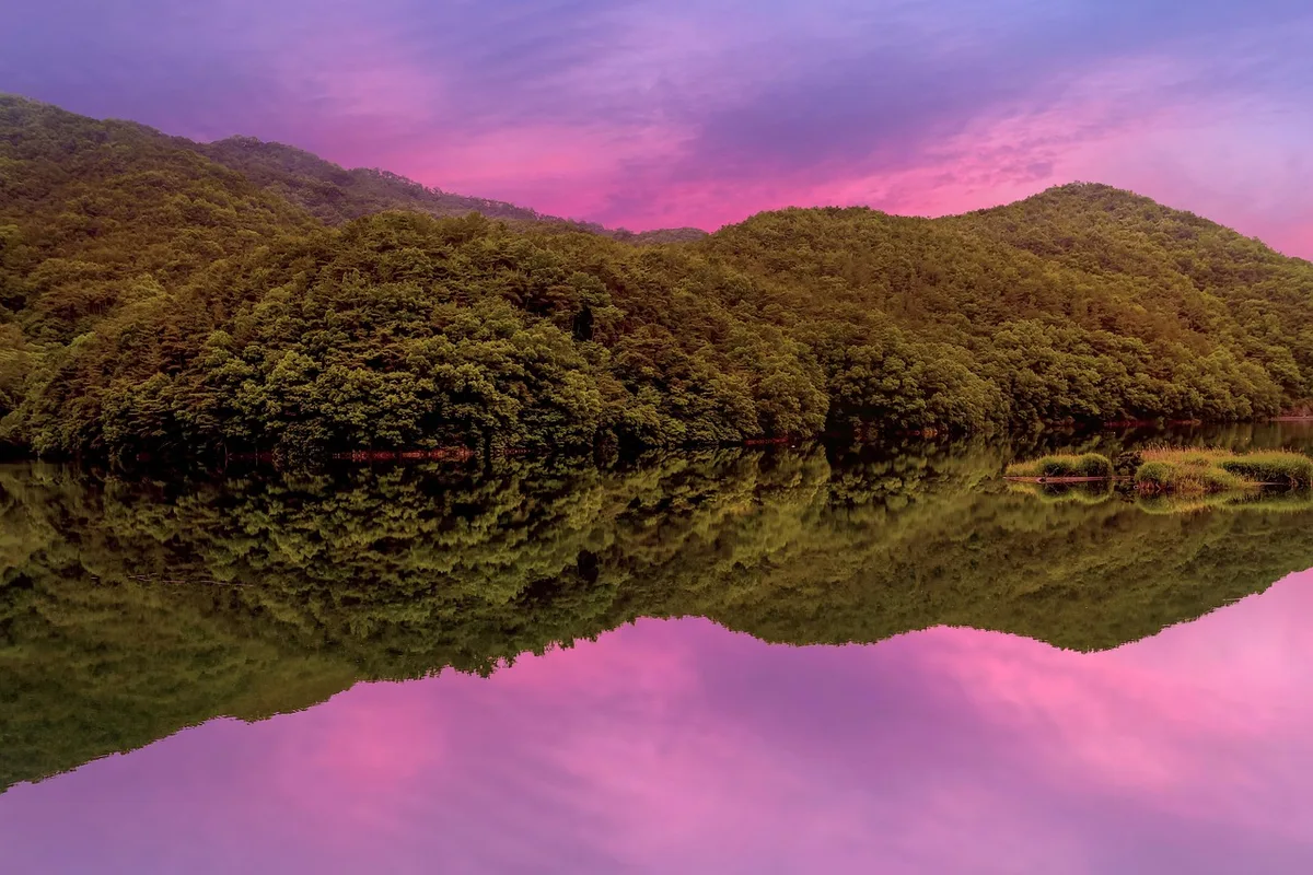
The hiking itself is a steady valley-to-ridge progression through elevation-zoned forest — warm broadleaf at the base, temperate oak and maple at mid-elevation, and subalpine fir and pine near the columnar formations. In spring, roughly 300,000 azaleas bloom across the mid-elevation slopes. In autumn, silver grass covers the upper ridge and the deciduous forest below turns orange and red against the grey hexagonal columns.
The cultural depth is unusual for a national park. Jeungsimsa Temple (860 CE) houses an Iron Vairocana Buddha — a 90-centimeter Unified Silla bronze seated in the Birojeon hall, designated a Treasure (보물) in 1963. The temple served as a headquarters for the Imje (Rinzai) school of Buddhism following the Imjin War and has maintained continuous monastic practice through the Korean War and its aftermath, though most original wooden structures were destroyed and subsequently rebuilt. Wonhyosa Temple on the eastern slope is named after the great Silla monk Wonhyo, who meditated at this site. It served as a training ground for the monk-general Yeonggyu, who later fought as a Buddhist warrior-monk during the Imjin War. The 1980 excavation during reconstruction revealed over 100 artifacts — bronze Buddha statues, mirrors, and clay sculptures spanning from Unified Silla through Joseon, documenting continuous habitation over a thousand years.
And the mountain's association with the May 18, 1980 Democratization Movement gives it a dimension no other Korean mountain carries. During the uprising, students and citizens fled military suppression into the mountain's slopes. Mudeungsan became both refuge and symbol — the "peerless mountain" above a city fighting for democratic representation. The National May 18 Democracy Cemetery in Gwangju maintains the historical record.
For comparison, Seoraksan has more dramatic granite towers and higher elevation. Chiaksan offers similar valley-to-ridge character with a higher summit. Compared to the granite peaks around Seoul, Mudeungsan offers a completely different volcanic landscape — and neither Seoraksan nor Chiaksan has the UNESCO designation or the columnar joints that make this mountain genuinely world-class.
Difficulty and Time Required
Mudeungsan is a moderate hike on the Jeungsimsa route — well-maintained trails with stone steps, installed ropes on the steeper sections, and a gradual 600-meter elevation gain over 5 kilometers. The upper section approaching Seoseokdae involves rock scrambling with height exposure, but the fixed ropes make it manageable for most hikers in reasonable fitness.
The route passes through distinct vegetation zones as it climbs. Below 400 meters, warm deciduous broadleaf forest dominates. The mid-elevation zone from 400 to 900 meters features oak and maple — the section responsible for both the azalea display in spring and the foliage color in autumn. Above 900 meters, the forest transitions to a coniferous-broadleaf mix with fir and Mongolian oak, and the columnar formations emerge from the subalpine terrain.
The Wonhyosa route is steeper and less maintained, with longer sections of sustained climbing through forest. The final 2.2 kilometers gain roughly 320 meters of elevation. The full circuit combining both approaches takes 5.5 to 6 hours and requires coordinating transport between the two parking areas.
The key fact for planning: the true summit is off-limits. Your destination is Seoseokdae (1,100m) and Ipseokdae — and these formations are more impressive than any summit view.
Trail Options
Jeungsimsa Route — Most Popular
The Jeungsimsa approach accounts for roughly 80% of Mudeungsan's annual visitors — over one million people per year pass through this trail system. From the Jeungsimsa parking area, the trail follows the valley through the temple complex, climbs a series of ridges, and arrives at the columnar formations.
Lower section — Parking to Jeungsimsa Temple (1.5km, 35 min)
A gentle paved path paralleling Jeungsimsa Stream through mixed forest. The temple — founded in 860 CE by the monk Cheolgam Seonsa and later restored in 1094 by the Goryeo-era monk Hyejo Guksa, then reconstructed under royal patronage in 1443 — sits in a clearing. The Iron Vairocana Buddha in the Birojeon hall is the primary cultural artifact: a 90-centimeter Unified Silla bronze, designated a Treasure (보물) in 1963. Temple stay programs are available year-round.
Mid section — Temple to Jangbuljae Pass (3km, 1.5h)
The trail leaves the valley and climbs through deciduous forest via stone steps. Unseobong and Saeinbong — twin peaks at roughly 488 meters, Saeinbong named for its dome shape resembling an imperial seal — provide the first open views. The gradient increases steadily. Hiking poles are useful through this section. The forest transitions from broadleaf to mixed conifer-deciduous as elevation increases.
Upper section — Jangbuljae to Seoseokdae and Ipseokdae (0.8km, 30 min)
The final approach to the columnar formations. The trail becomes rocky scramble with installed ropes on the steepest sections. Seoseokdae appears first — a wall-like formation where the columns remain fused, resembling a stone fortress. Ipseokdae, 300 meters further, is where individual columns have separated through weathering — roughly 40 distinct stone pillars standing 1 to 2 meters wide, the most photographed geological feature in Gwangju.
The columns do not photograph like anything else in Korean hiking. They are geometric, massive, and visibly volcanic. Standing at the base and looking up at 20 meters of hexagonal rock is the moment that justifies the trip.
Round trip via Jeungsimsa: approximately 5 to 6 hours. Suitable for adults in moderate fitness with proper footwear.
Best for: First-time visitors, anyone wanting the columnar joints with the most accessible approach, temple visit.
Wonhyosa Route — Quieter Alternative
The eastern approach through Wonhyosa Temple offers deeper forest, fewer hikers, and a different angle on the columnar formations. The trail follows the historic Mudeungsan Old Path — a partially restored pre-modern pilgrimage route — through old-growth forest with stream crossings to Seoseokdae.
Wonhyosa Temple was likely founded in the Silla period and is named after the monk Wonhyo, who meditated at this site. The monk-general Yeonggyu trained here before fighting in the Imjin War, and the temple was rebuilt after the Japanese invasions by the monk Seokgyeong, who fired the roof tiles himself. A 1980 excavation during reconstruction revealed over 100 artifacts spanning Unified Silla through Joseon — bronze Buddha statues, mirrors, and clay sculptures documenting continuous habitation over a thousand years.
The trail is steeper and less maintained than the Jeungsimsa approach. The final 2.2 kilometers gain roughly 320 meters of elevation through sustained climbing in forest.
Round trip: approximately 5 to 7 hours.
Best for: Those seeking quieter trails, archaeological interest, repeat visitors, experienced hikers.
Full Circuit — Complete Experience
The loop hike ascends via one route and descends via the other, covering approximately 10 kilometers and passing through both temple complexes and the full columnar formation zone. Allow 5.5 to 6 hours. This requires coordinating transport between the Jeungsimsa and Wonhyosa parking areas — taxi from one to the other takes approximately 20 minutes.
The recommended direction is Jeungsimsa up, Wonhyosa down — the Jeungsimsa approach is better maintained for ascending, and the Wonhyosa descent, while steeper, is manageable with care.
Best for: Those with a full day, anyone wanting the complete Mudeungsan experience.
Best for Most Travelers
If you have one day in Gwangju and moderate fitness: Jeungsimsa route up and back. Five to six hours round trip, a 9th-century temple at the base, elevation-zoned forest through the middle, and the columnar formations as the payoff. The trail is well-maintained with stone steps and installed ropes, and the 600-meter elevation gain is distributed over 5 kilometers — steady but not punishing.
If you have a full day and want the complete experience: Jeungsimsa up, Wonhyosa down. Ten kilometers, 5.5 to 6 hours, both temple complexes, and the full circuit through the columnar formation zone. Arrange a taxi between the two parking areas in advance.
If you are coming from Seoul as a day trip: KTX to Gwangju Songjeong Station takes approximately 2 hours. Bus 1187 from downtown Gwangju delivers you to the Jeungsimsa entrance in 30 minutes. A focused Jeungsimsa round trip — temple visit, climb to Seoseokdae, return — fits comfortably into a day trip with an early KTX departure.
Who Should Do This Hike
Mudeungsan suits hikers interested in geology, cultural heritage, or both. The Jeungsimsa route is appropriate for anyone in moderate fitness with proper footwear — the trail is well-maintained and the fixed ropes on the upper sections make the scrambling manageable. The Wonhyosa route requires more sustained effort and is better suited to experienced hikers.
The mountain is not suitable for casual footwear above the temple level. The upper rock scrambling requires hiking boots with grip and ankle support. In winter, crampons are necessary above 1,000 meters.
The columnar formations are genuinely unique in Korean hiking. If you are visiting Gwangju — or considering a day trip from Seoul via KTX — Mudeungsan is the primary reason to come. The combination of UNESCO-designated geology, 9th-century temple heritage, and accessible trail infrastructure does not exist elsewhere in the country.
Tips Before You Go
- Bring at least 2 liters of water. There are facilities at the temple level but nothing above Jangbuljae Pass.
- The true summit (Cheonwangbong, 1,187m) is a military restricted zone. Do not attempt to access it. Seoseokdae at 1,100m is the highest accessible point.
- Do not climb on the columnar formations. They are Natural Monument No. 465 — touching, climbing, or removing rock is prohibited and subject to fines up to 10 million KRW for damage to protected heritage.
- Wet rock on the upper sections is slippery. Avoid the Seoseokdae approach after rain.
- In spring, roughly 300,000 azaleas bloom across the mid-elevation slopes — peak season is late March to April. In autumn, silver grass covers the upper ridge from late September to October.
- The mountain supports the Mudeungsan butterbur (Petasites japonicus subsp. mutabilis), an endemic plant found only in this region. Stay on marked trails to protect its riparian habitat.
- Bus 1187 runs directly from downtown Gwangju to the Jeungsimsa entrance — the bus number matches the peak elevation.
- Yaksasa Temple (also known as Yaksaam), founded during the Unified Silla period under its original name Inwangsa, sits on the eastern slopes and is designated a Gwangju Municipal Cultural Asset. It is accessible as a side visit from the Wonhyosa approach.
- Emergency number: 119. National Park hotline: 1330 (English available). Mudeungsan Park headquarters: +82-62-625-0761.
How to Get There
From Seoul (KTX — recommended): Take KTX from Seoul Station or Yongsan Station to Gwangju Songjeong Station. Journey time is approximately 2 hours. From Gwangju Songjeong, take the subway or bus to the Jeungsimsa trailhead. Total travel time from Seoul is approximately 3 hours.
From Gwangju city center: Bus 1187 runs directly from downtown Gwangju to the Jeungsimsa entrance. Travel time is approximately 30 minutes.
By car: Approximately 330km from Seoul via Honam Expressway, roughly 3.5 hours. Parking is available at both the Jeungsimsa and Wonhyosa areas.
Use Naver Maps for real-time transit directions on the day.
Final Thoughts
Mudeungsan is the mountain you come to for the geology. The columnar jointed rock at Seoseokdae and Ipseokdae — hexagonal columns of volcanic tuff standing 20 meters tall, up to 9 meters wide, 84 million years old — is unlike anything else on a Korean hiking trail. The UNESCO Global Geopark designation is not honorary; it reflects formations that hold up against columnar joints anywhere in the world. Research published in Earth, Planets and Space identifies these as distinctive welded tuff columns — different in composition and scale from the basaltic formations found at sites like the Giant's Causeway or Jeju's Jusangjeolli.
The hiking wraps that geology in a well-structured trail through 9th-century temple grounds, elevation-zoned forest, and a ridge approach that builds anticipation before delivering the formations as a payoff. For visitors who have hiked Seoul's granite peaks, Mudeungsan is a fundamentally different mountain experience — volcanic rather than granitic, columnar rather than smooth, and anchored in a city whose modern history gives the mountain a weight beyond its geology.
The name itself — "Peerless Mountain," the mountain beyond ranking — was not chosen lightly. It reflects a place where geological time, Buddhist contemplation, and democratic resistance have all converged on a single set of slopes. Whether you come for the columns, the temples, or the history, Mudeungsan delivers on its name.
For the best hikes reachable directly from Seoul by subway, see the full Seoul hiking guide.
Related Guides
Explore more hiking in Korea:
- Best hikes in Seoul — full overview of Seoul's mountains by subway
- Seoraksan Hiking Guide — Korea's top hiking destination
- Chiaksan Hiking Guide — national park, Gangwon Province
FAQ
How difficult is the Mudeungsan hike to Seoseokdae? The Jeungsimsa route is rated Moderate. The trail is well-maintained with stone steps and installed ropes on the steeper sections. The 5-kilometer ascent gains 600 meters of elevation and takes 2.5 to 3 hours. The upper rock scrambling requires reasonable fitness and proper footwear.
Can I reach the summit of Mudeungsan? The true summit (Cheonwangbong, 1,187m) is a military restricted zone and not accessible to hikers. The highest accessible point is Seoseokdae at 1,100 meters, where the columnar jointed rock formations are located.
How do I get to Mudeungsan from Seoul? Take KTX from Seoul Station to Gwangju Songjeong Station (approximately 2 hours), then Bus 1187 from downtown Gwangju to the Jeungsimsa entrance (30 minutes). Total travel time is approximately 3 hours.
What is the best time to visit Mudeungsan? October is peak season for autumn foliage and silver grass on the upper ridge. Late March to April brings 300,000 azaleas on the mid-elevation slopes. Both seasons draw large crowds on weekends — arrive early or visit on weekdays.
What are the columnar joints at Mudeungsan? Seoseokdae and Ipseokdae are formations of hexagonal columnar jointed rock — quartz andesite tuff formed 84 to 87 million years ago. The columns are up to 9 meters wide and stand in walls 20 to 24 meters tall. They are designated Natural Monument No. 465 and are part of the UNESCO Global Geopark.
What should I bring for hiking Mudeungsan? Hiking boots with ankle support and good grip for the upper rock scrambling. At least 2 liters of water. Sun protection and a wind layer for the exposed ridge. In winter, crampons are needed above 1,000 meters. Do not touch or climb on the columnar formations.
Continue exploring Korea's mountains
More routes, same honest field notes.
Related guides

Same region
EasyByeonsanbando Hiking Guide: Sea Cliffs and Naesosa
A practical guide to hiking Byeonsanbando — Korea's only peninsular national park, with Chaeseokgang UNESCO sea cliffs, Jikso Falls, and Naesosa fir forest.

Same region
ModerateDeogyusan Hiking Guide: Gondola Summit and Valley
A practical guide to hiking Deogyusan National Park in Muju — the gondola route to Hyangjeokbong summit at 1,614m, Gucheondong Valley, and winter rime flowers.

Same region
ModerateNaejangsan Hiking Guide: Korea's Best Autumn Foliage
A practical guide to hiking Naejangsan National Park — Korea's premier autumn foliage destination with the Danpung Tunnel, Sinseonbong summit, and KTX access.