Namsan Hiking Guide: N Seoul Tower and Trail Options
A practical guide to hiking Namsan in Seoul — trail routes to N Seoul Tower, the cable car option, night walks, and how to get there from Myeongdong station.

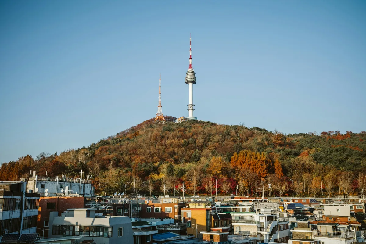
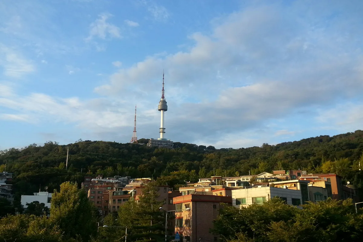
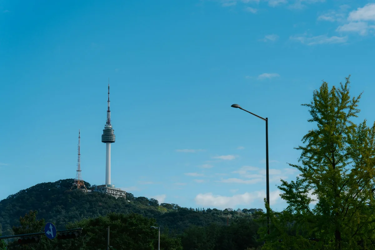
Namsan is 262 meters tall and sits at the geographic center of Seoul. N Seoul Tower stands at the summit, visible from most of the city. The mountain is open 24 hours, free to enter, and accessible from five different subway stations — making it the most visited hill in the country and one of the easiest options for hiking in Seoul.
The mountain's geology is part of the Gyeonggi gneiss terrain — the ancient granite and gneiss bedrock that underlies much of Seoul. Namsan itself is a low-elevation hill shaped by the Han River's erosion over millennia, forming a gentle ridge between Jung-gu and Yongsan-gu. The underlying rock is old, but the forest is recent: the original woodland was largely destroyed during the Japanese occupation when the Joseon Shingung (Shinto shrine) was built on the slopes between 1925 and 1945. The pine forests visitors walk through today are the result of restoration work that began in the 1960s after the park was formally established in 1968.
Namsan's cultural identity runs deeper than the tower. In the Joseon-era feng shui cosmology of Hanyang (Seoul's former name), Namsan occupied the position of Jujak — the Vermillion Bird of the south — one of the four guardian mountains (naesasan) that enclosed and protected the capital. The Hanyang city wall, first built in 1396, runs approximately 5.5 kilometers along Namsan's ridgeline as part of the total 18.6-kilometer defensive circuit that connected Bugaksan (north), Naksan (east), and Inwangsan (west). The Mokmeok Beacon Tower at the summit served as the terminus of the entire national signal fire network from 1423 to 1895.
It is not a challenging hike by any standard. That is part of the point. Namsan is the mountain for visitors who want the Seoul skyline view without a full-day commitment, for families combining sightseeing with a short trail walk, and for anyone who wants to understand the city's geography from above before exploring at street level. Compared to Bukhansan, which demands 3 to 5 hours of sustained climbing, or Gwanaksan, which involves steep granite scrambling, Namsan offers the reward — the panoramic view — with minimal physical commitment.
Quick Info
Quick summary for planning your Namsan hike at a glance.
- Location: Jung-gu / Yongsan-gu, Seoul, South Korea
- Summit: 262m (N Seoul Tower at summit)
- Difficulty: Easy
- Best Time to Visit: Year-round — sunset and evening visits particularly popular
- Entrance Fee: Free (park) / ₩29,000 (N Seoul Tower Observatory)
- Cable Car: ₩15,000 round trip — 3-minute ride from Myeongdong
- Park Hours: 24 hours / Best hiking: 06:00–22:00
Trail Overview
| Route | Distance | Elevation Gain | Time | Difficulty | Best For |
|---|---|---|---|---|---|
| North Circular Trail | 3.4km | varies | 1–1.5h | Easy | Families, first-timers |
| South Circular Trail | ~4km | varies | 1.5h | Easy | Quieter, forested |
| Full Circular Loop | 7.5km | ~300–400m cumulative | 2.5–3h | Easy–Medium | Complete experience |
| Historic Culture Path | 0.6km | varies | 20–30 min | Easy | History, cultural sites |
| Cable Car + Walk | minimal | ~130m | 30–60 min | Very Easy | Accessibility, speed |
Why Namsan Is Worth Visiting
Namsan does not compete with Bukhansan or Dobongsan for serious hikers. Its role in Seoul's outdoor landscape is different — it is the mountain that anchors the city center, the place where geography and sightseeing overlap most naturally.
The view from the summit looks north toward Gyeongbokgung and Bugaksan, east toward the Han River, and south toward Gangnam. On a clear evening, with the tower lit up and the city spread below in every direction, it delivers something that the more remote northern peaks do not: the full visual weight of Seoul from directly above.
The trail system itself is more varied than most visitors expect. The Historic Culture Path follows the original 1396 Hanyang city wall alignment and passes the Mokmeok Beacon Tower site, the An Jung-geun Memorial Hall, and remnants of Joseon-era defensive infrastructure. The Nature Ecology Path supports over 1,170 documented species including a resident population of red squirrels — approximately 300 were reintroduced in 1990, with 50 more added in 2005, and the population has since stabilized as one of Seoul's visible urban wildlife success stories.
The cultural sites along Namsan span multiple layers of Korean history. The original Guksadang (national shrine) once stood at the summit, where the Joseon state conducted official rites to Mokmeok-daewang — the mountain spirit that King Taejo elevated to divine status as protector of the capital. During the Japanese occupation, the shrine site was replaced by the Joseon Shingung, a Shinto shrine that symbolized colonial subjugation. After liberation, that history was deliberately overwritten: the An Jung-geun Memorial Hall (reopened in its current form in 2010) now stands on part of the former Shinto shrine grounds, honoring the independence activist who assassinated Japan's first Resident-General of Korea in 1909.
For a more demanding hike with similar cultural depth, Inwangsan offers the city wall experience with significantly more elevation and fewer crowds. For a full-day challenge within Seoul, Bukhansan National Park or Dobongsan provide serious ridge hiking. And for another easy option with a different character, Achasan on the eastern side of the city offers Han River views from a similar elevation with far fewer visitors.
Difficulty and Time Required
Every Namsan route is accessible to most fitness levels, making it one of the most popular easy hikes in Seoul. The circular trail gains elevation gradually with no steep scrambling. The cable car eliminates the uphill entirely. The Historic Culture Path is essentially flat. The most strenuous option — the full 7.5-kilometer loop — takes 2.5 to 3 hours at a leisurely pace and involves approximately 300 to 400 meters of cumulative elevation gain spread across gentle inclines.
The direct stair climb from the Myeongdong area to the tower base is the most physically demanding approach — approximately 200 meters of elevation gain on continuous steps — but even this takes only 30 to 45 minutes. Fitness enthusiasts use this route for hill repeats, but for most visitors, the paved circular trails or the cable car are more appropriate.
This is genuinely the most accessible serious viewpoint in central Seoul.
Trail Options
North Circular Trail — Most Popular Walking Route
The North Circular Trail (bukcheugsunhwanro) is 3.4 kilometers of paved, vehicle-free path running from the cable car base station near Myeongdong up and around the northern slopes of Namsan. The surface is smooth and accessible to strollers and wheelchairs throughout — no vehicles, bicycles, or e-scooters are permitted. Multiple viewing platforms face north toward the city skyline, and the dense forest canopy provides shade on hot days.
Most visitors use this as the primary approach to the summit on foot, taking approximately 1 to 1.5 hours at a relaxed pace. The descent can be made via the same route or by cable car.
Best for: Families, first-time visitors, anyone wanting a straightforward summit walk.
Historic Culture Path — Best for History
The 640-meter Historic Culture Path follows the alignment of the original 1396 Hanyang city wall along Namsan's ridge. Key sites along the route include the Mokmeok Beacon Tower pavilion — an octagonal structure marking the location of the original signal fire tower that served as the terminus of Korea's national communication network from 1423 to 1895 — the An Jung-geun Memorial Hall, Baekbeom Square (dedicated to independence leader Kim Ku), and the Walyong Tomb, a traditional burial site integrated into the trail.
The path takes 20 to 30 minutes at a relaxed pace and can be combined with any of the longer circular routes. Interpretive plaques along the route are available in Korean and English.
Best for: Visitors interested in Korean history, those combining Namsan with other cultural sites in central Seoul.
Full Circular Loop — Best Complete Experience
The complete Namsan loop covers 7.5 kilometers and passes through all five trail sections: North Circular, Historic Culture Path, Nature Ecology Path (approximately 1,650 meters through restored pine and oak forest), Wild Flowers Path (approximately 850 meters with seasonal blooms including azalea in spring and chrysanthemum in autumn), and Forest Path (approximately 910 meters of unpaved dirt trail through the densest woodland on the mountain). Allow 2.5 to 3 hours. The loop can be started from any of the five subway access points and is well-marked throughout.
The Nature Ecology section on the eastern slope is the quietest stretch — red squirrels are frequently spotted here in the early morning and around dusk, particularly in autumn when they are most active collecting acorns from the oak trees.
Best for: Those who want the full Namsan experience, repeat visitors, nature and wildlife interest.
Cable Car — Quickest Option
The Namsan Cable Car runs from near Myeongdong Station to the summit in approximately 3 minutes. The cable car first opened in 1962 and covers a distance of 605 meters. Round trip costs ₩15,000, with one-way tickets available for ₩12,000. Operating hours are 10:00 to 23:00 daily. On weekends and during peak tourist season, queues can form — arrive early or use the walking trail upward and take the cable car down.
The cable car is the right choice for visitors with limited mobility, those short on time, or anyone who wants to reach the tower for sunset without the 45-minute walk.
Best for: Accessibility, evening visits, those combining tower admission with the cable car ticket.
N Seoul Tower
N Seoul Tower sits at the summit of Namsan. Construction began in 1969, and the tower was completed in 1975 as Korea's first integrated broadcast transmission tower — handling TV and radio signals for the national network. It opened to the general public in 1980. The tower structure is 236 meters tall, bringing the total height above sea level to approximately 480 meters (262 meters mountain elevation plus 236 meters tower).
The Observatory admission is ₩29,000 for adults, with online discounts available (approximately ₩18,400 through advance booking platforms). The tower houses N.Grill, a Michelin-recommended rotating restaurant, and HanCook for Korean cuisine — reservations at either restaurant include free observatory access.
The tower is illuminated each evening, changing colors for designated causes and events. The view from the observation decks extends across the entire Seoul metropolitan area on clear days — winter offers the clearest visibility due to reduced atmospheric haze. The famous "love locks" installation on the lower fence has accumulated tens of thousands of padlocks left by couples over the years.
Tower hours: 10:00 to 23:00 daily.
Namsangol Hanok Village
At the base of Namsan's southern slope, Namsangol Hanok Village (opened in 1998) features five reconstructed traditional Joseon-era houses. The village includes a folk museum, traditional craft workshops, and performance spaces for Korean classical music including jeongak and pansori. Visitors can rent hanbok (traditional Korean clothing) for photographs in the village grounds. The site is free to enter and serves as a natural complement to the mountain hike — many visitors combine a Namsan trail walk with a stop at the village.
Best for Most Travelers
If you have a single afternoon or evening in Seoul and want a view: walk the North Circular Trail to the summit, watch sunset from the tower area, and take the cable car down. This combination takes roughly 2 hours total including the descent, requires no fitness beyond comfortable walking, and delivers the best skyline view in Seoul.
If you want more depth and have 3 hours: the Full Circular Loop covers all five trail sections — nature, history, wildflowers, and forest — and returns you to your starting point. This is the route that reveals Namsan as more than a tower hill. The Nature Ecology Path and the Forest Path sections are genuinely quiet, even on busy weekends.
If you are short on time or have mobility limitations: the cable car to the summit followed by a short walk around the tower plaza takes under an hour and still provides the panoramic view.
Who Should Do This Hike
Namsan is appropriate for everyone — families with young children, elderly visitors, non-hikers accompanying others, and serious hikers looking for a low-effort afternoon before or after a more demanding day. The 24-hour park access and multiple subway entry points make it the most logistically flexible mountain in Seoul.
The only visitors for whom Namsan may feel underwhelming are experienced hikers expecting technical terrain. For that, Dobongsan or Gwanaksan offer more challenge within the city network.
Tips Before You Go
- The sunset view from the summit is one of the best in Seoul — plan your visit to arrive 30 to 45 minutes before sundown.
- Water fountains are available along the main trails. The routes are short enough that 500ml to 1 liter is sufficient for most visits.
- Trail signs throughout the park are in Korean, English, Chinese, and Japanese — navigation is straightforward without a guide.
- The circular trail is popular with evening joggers. The pace of foot traffic picks up significantly after 18:00 on weekdays.
- Cherry blossoms line the lower trails in early April, and autumn foliage peaks from mid-October through late October. The Wild Flowers Path features azalea in spring, miscanthus grass in October, and chrysanthemum through November.
- Peak ginkgo foliage season and autumn weekends bring large crowds. Weekday mornings offer the quietest experience.
- N Seoul Tower observatory tickets purchased online in advance are significantly cheaper than on-site pricing — check booking platforms before your visit.
- The Forest Path (sanrimsupgil) section is unpaved dirt trail and may be slippery after rain. All other sections are paved.
- Emergency number: 119. Seoul city information (English available): 120.
How to Get There
From Hoehyeon Station (Line 4, Exit 4 — closest to summit): Walk approximately 8 minutes south toward Namsan Park. This is the most direct subway access to the upper trail area.
From Myeongdong Station (Line 4, Exit 3 — cable car access): Walk approximately 10 to 15 minutes to the cable car base station. Use this approach for the cable car or the North Circular Trail.
From Chungmuro Station (Lines 3 and 4, Exit 5): Walk approximately 10 to 20 minutes to the eastern trail entrance, or take Bus 140 to the Namsan 1-tunnel stop (5 minutes) and walk 3 minutes to the park entrance. Good starting point for the Historic Culture Path and South Circular Trail.
All access points are on Line 3 or Line 4. Use Naver Maps or Google Maps for real-time routing on the day.
Final Thoughts
Namsan is not Seoul's most demanding hike, but it may be its most useful one. The combination of central location, multiple access points, 24-hour availability, and the tower view makes it the natural starting point for understanding Seoul's geography before heading to the more serious mountains.
For a first evening in Seoul, the walk up via the North Circular Trail followed by sunset at the tower summit is one of the better ways to orient yourself to the city. The layers beneath the surface — the Joseon city wall, the beacon tower terminus, the colonial-era shrine replaced by an independence memorial — add historical weight that most visitors only discover once they are on the trail.
If you're planning multiple hikes in Seoul, start here: Best hikes in Seoul — all mountains by difficulty and subway access
Related Guides
Explore more hiking in Seoul:
- Best hikes in Seoul — full overview by difficulty and subway access
- Inwangsan Hiking Guide — city wall hike near Gyeongbokgung
- Bukhansan Baegundae Hiking Guide — Seoul's highest summit
- Gwanaksan Hiking Guide — challenging granite ridges in southern Seoul
- Achasan Hiking Guide — easy riverside hike on Seoul's east side
FAQ
Is Namsan free to hike? Yes. Namsan Park is free to enter 24 hours a day. The N Seoul Tower Observatory charges ₩29,000 for adults. The cable car costs ₩15,000 round trip. All hiking trails within the park are free.
How long does it take to hike Namsan to N Seoul Tower? Walking up via the North Circular Trail takes approximately 45 minutes to 1 hour from the Myeongdong cable car base. The full circular loop takes 2.5 to 3 hours. The cable car reaches the summit in 3 minutes.
What is the best time to visit Namsan? Sunset and evening visits are the most popular — the tower is illuminated after dark and the city view is exceptional. Spring (April) brings cherry blossoms along the lower trails. Autumn (October to November) offers fall foliage. The park is accessible year-round at any hour.
How do I get to Namsan from Myeongdong? From Myeongdong Station (Line 4, Exit 3), walk approximately 10 to 15 minutes to reach the cable car base station or North Circular Trail entrance. The cable car ride to the summit takes 3 minutes and costs ₩15,000 round trip.
Is Namsan suitable for families with young children? Yes. The North Circular Trail is paved and accessible to strollers and wheelchairs. The cable car is appropriate for all ages. There are restrooms, water fountains, and rest areas throughout the park.
Can I hike Namsan at night? Yes. Namsan Park is open 24 hours and the main trails are used regularly after dark by locals. The trail is partially illuminated along the main sections. The tower is open until 23:00.
Continue exploring Korea's mountains
More routes, same honest field notes.
Related guides

Nearby hikes
EasyAchasan Hiking Guide: Han River Views and Sunrise
A practical guide to hiking Achasan in Seoul — the main summit route, the Achasan-Yongmasan ridge traverse, Han River sunrise views, and subway directions.

Nearby hikes
EasyInwangsan Hiking Guide: Easy Hike Near Gyeongbokgung
A practical guide to hiking Inwangsan in Seoul — the Sajik Park route, Seoul City Wall trail, Seonbawi Rock, and how to get there by subway from the palace.

Nearby hikes
HardBukhansan Hiking Guide: Baegundae Summit in Seoul
A practical guide to hiking Bukhansan National Park in Seoul — Baegundae summit routes, Bukhansanseong Fortress, Insubong rock climbing, and subway access.