Mount Fuji Hiking Guide: Yoshida Trail, Permits, and How to Get There from Tokyo
A practical guide to climbing Mount Fuji — Japan's highest mountain at 3,776m, including the four official trails, the 2025 reservation system, summit sunrise (Goraiko), and bus access from Tokyo.

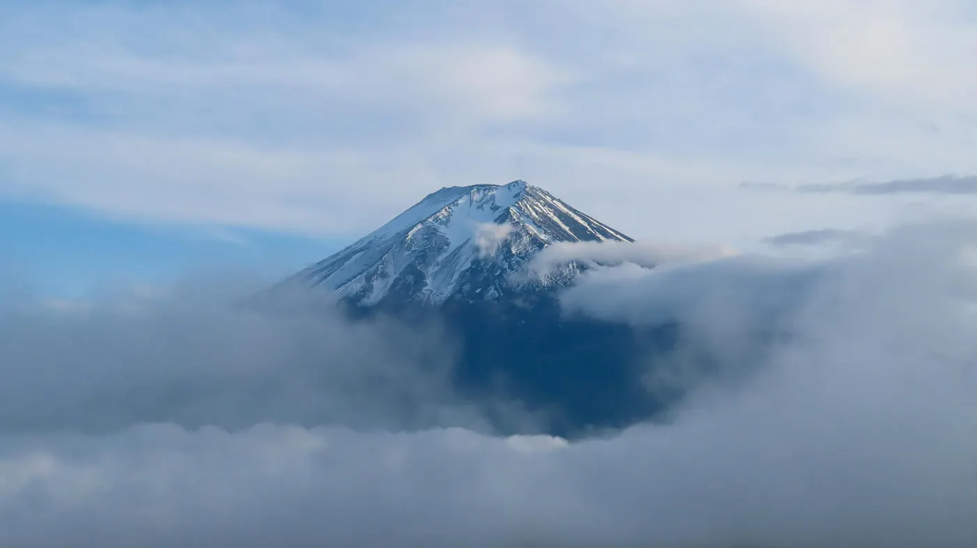
Mount Fuji (3,776m) is Japan's highest mountain and one of the most accessible high-altitude climbs in Asia. The hike is short but physically demanding, with four official trails, mandatory online registration, and a 10-week climbing window from July to mid-September. Since 2025, climbing requires advance booking, a 4,000 yen fee, and strict daily entry limits — making Fuji one of the most regulated mountains in the world.
Most climbers who fail on Fuji do not fail because of fitness. They fail because they underestimate altitude, weather, and the permit system. This becomes obvious above the 8th station, where even fit hikers slow down dramatically.
The mountain sits on the border of Yamanashi and Shizuoka prefectures, roughly 100 kilometers west of Tokyo. For most international travelers, Mount Fuji is the easiest high-altitude climb accessible directly from a major Asian capital — direct buses from Shinjuku reach the Yoshida Trail 5th Station in about 2.5 hours. The standard approach is a two-day climb with a hut stay at the 7th or 8th station for altitude acclimatization, summiting before dawn for Goraiko — the sunrise from the crater rim.
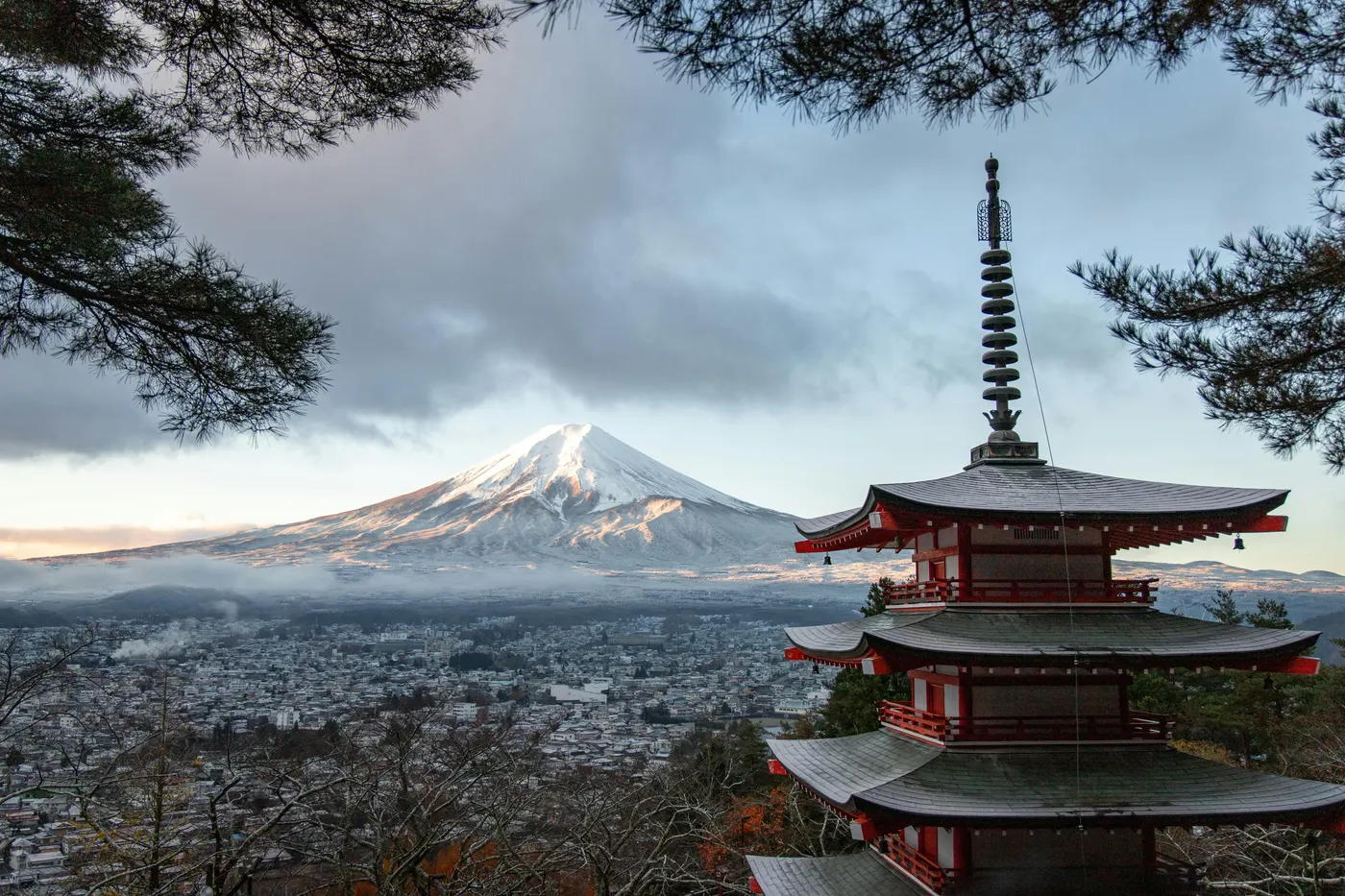
Mount Fuji is an active stratovolcano. Its last eruption, the Hōei eruption of 1707, covered Edo (modern Tokyo) in volcanic ash. Three volcanoes stacked vertically over hundreds of thousands of years produced the perfectly symmetrical cone visible today. The mountain was inscribed as a UNESCO World Heritage Site in 2013 — listed as a cultural landscape, not a natural one, recognized for its sacred role in Japanese religion and its influence on art that reshaped Western painting. The summit area above the 8th station is officially shrine land, owned by Fujisan Hongū Sengen Taisha, the head shrine of all 1,300 Sengen shrines in Japan.
For hikers planning multiple Asian climbs, Fuji is best understood alongside Korea's Hallasan (1,950m) and Seoraksan — though it is significantly higher and more strictly regulated than either. For an easier introduction to mountain hiking in the region, the Seoul hiking guide covers accessible day hikes reachable by subway. Mount Fuji is not just a hike — it's a pilgrimage with a mountain underneath it.
⚠️ 2025 Climbing Restrictions (Read First)
Starting in 2025, Mount Fuji requires advance booking, a ¥4,000 fee, and limits climbers to 4,000 people per day on the Yoshida Trail. Walk-up climbing is no longer possible.
What you must do before climbing:
- Online registration at fujisan-climb.jp/en/
- Pay 4,000 yen entry fee per person, per trail
- Complete the mandatory online safety course (about 30 minutes)
- Register passport number (foreign climbers)
- Receive QR digital ticket — checked at the trail gate
Daily caps and booking windows:
- Yoshida Trail: 4,000 climbers per day. 3,000 advance slots, 1,000 same-day slots released at 00:01 JST. Weekend same-day slots usually sell out before 6 AM.
- Other trails: Lower caps, less competitive but reservation still required.
Hut reservation requirement (2025 onward): Climbing the Yoshida Trail between 14:00 and 03:00 the next day requires proof of mountain hut reservation. This was introduced to stop bullet climbing (弾丸登山) — overnight forced ascents that have caused fatalities from hypothermia and altitude sickness.
The official climbing season is short: July 1 to September 10 for the Yoshida Trail, July 10 to September 10 for the other three trails. Outside this window, all huts close, restrooms lock, and emergency services are not staffed.
Quick Info
Quick summary for planning your Mount Fuji climb at a glance.
- Location: Yamanashi / Shizuoka Prefecture, Japan
- Highest Peak: Kengamine, 3,776m (Japan's highest)
- Difficulty: Moderate–Hard (altitude, distance, weather)
- Climbing Season: July 1 – September 10 (Yoshida) / July 10 – September 10 (other trails)
- Entry Fee: 4,000 yen per person (all trails, 2025 onward)
- Reservation: Required via fujisan-climb.jp
- UNESCO: World Heritage cultural site (2013)
- Travel Time from Tokyo: ~2.5 hours by direct bus
Trail Overview
| Trail | Start (5th Station) | Distance (one-way) | Elevation Gain | Time Up | Time Down | Difficulty |
|---|---|---|---|---|---|---|
| Yoshida (most popular) | Fuji Subaru Line 5th (2,305m) | 6.8km | +1,471m | 5–7h | 3–5h | Moderate (most accessible) |
| Fujinomiya (shortest) | Fujinomiya 5th (2,400m) | 4.3km | +1,376m | 5–7h | 3–4h | Moderate |
| Subashiri (forested) | Subashiri 5th (1,970m) | 6.9km | +1,806m | 5–7h | 2–4h | Moderate–Hard |
| Gotemba (longest) | Gotemba 5th (1,440m) | 10.5km | +2,336m | 8–9h | ~4h | Hard |
Best Trail for Most Travelers
If you only have one climb, the Yoshida Trail with a 7th or 8th station hut overnight is the best choice for nearly everyone. It has the most huts, the best emergency support, and the most direct transport from Tokyo.
For other priorities:
- Yoshida Trail — most accessible from Tokyo, most facilities, best for first-time climbers (with proper preparation)
- Fujinomiya Trail — shortest distance to the summit, but the steepest grade
- Subashiri Trail — quieter forest start, includes the Osunabashiri sand-run descent
- Gotemba Trail — longest and most demanding, fewer huts, for experienced mountaineers only
If you're not sure: book Yoshida.
Why Mount Fuji Is a Different Kind of Climb
Mount Fuji's scale and regulation set it apart from most mountains reachable as a single trip from Asian cities. The summit elevation of 3,776 meters is more than twice that of Hallasan (1,950m) — Korea's highest peak — and the climb itself is significantly more committed. Above 3,000 meters, altitude sickness affects roughly 30% of climbers regardless of fitness, and the standard prevention is a hut stay at the 7th or 8th station for acclimatization.
The cultural framing is also unique. Fuji has been worshipped as a sacred mountain since at least the 9th century, when frequent eruptions led to the construction of Sengen shrines at its base to appease the volcano's anger. By the Edo period, climbing Fuji had become a structured religious practice — the Fujikō confraternities organized annual pilgrimages from Edo (modern Tokyo), and ordinary citizens climbed in white robes. Women were banned from the summit until 1872. The summit crater above the 8th station is still officially shrine land.
The artistic legacy carries similar weight. Hokusai's Thirty-six Views of Mount Fuji (1830–1832) — the woodblock series containing "The Great Wave off Kanagawa" — exported Japanese visual culture to Europe and influenced Van Gogh, Monet, and Debussy. The mountain on the back of every 1,000 yen note is Fuji.
What separates Fuji most clearly from Korean mountains is the permit-based access model. Korean national parks operate on near-open access — most trails require no booking, no fee, and no advance planning. Fuji operates on quota, fee, and mandatory pre-registration, closer to how access works at Half Dome in Yosemite, Angels Landing in Zion, or Mount Whitney in California. If you've hiked Hallasan or Seoraksan, expect Fuji to feel structurally different from the start — the planning begins weeks before you arrive at the trailhead. For a gentler introduction to mountain hiking in the region, the Seoul hiking guide covers accessible day hikes reachable by subway, with no permits or quotas.
Difficulty and Time Required
Fuji is harder than its trail map suggests. The challenges are altitude, weather, and time pressure — not technical climbing.
Altitude. The 5th stations sit at 1,440 to 2,400 meters, but the summit is 3,776 meters. Above 3,000 meters, altitude sickness affects roughly 30% of climbers regardless of fitness. Symptoms include headache, nausea, fatigue, and impaired judgment. Sleeping at a 7th or 8th station hut (around 3,000m) for 4 hours of acclimatization is the standard prevention.
Weather. Summit temperatures average 5–8°C in summer, dropping to near 0°C overnight. Wind chill at high winds can push the effective temperature below -10°C. Afternoon thunderstorms are common — most climbers start before noon or at night. The mountain has its own weather; conditions at the 5th station tell you nothing about the summit.
Distance and grade. The Yoshida Trail covers 6.8 kilometers one-way with 1,471 meters of elevation gain. Most climbers take 5 to 7 hours up, 3 to 5 hours down. The Gotemba Trail is significantly longer — 10.5 kilometers and over 2,300 meters of gain.
Bullet climbing warning. Attempting to climb overnight without rest ("bullet climbing") is strongly discouraged due to altitude sickness risk and extreme fatigue. The 2025 hut-reservation requirement for nighttime entry on the Yoshida Trail is specifically designed to prevent this practice.
Trail Options
Yoshida Trail — Most Popular
The Yamanashi-side route, closest to Tokyo and the most developed of the four. Roughly 60% of all Fuji climbers use this trail.
The trail starts at the Fuji Subaru Line 5th Station (2,305m) and covers 6.8 kilometers one-way, with 1,471 meters of elevation gain. Most climbers take 5–7 hours up and 3–5 hours down. The route has 17 mountain huts — the most of any trail — and includes a safety guidance center at the 6th station and emergency medical posts at the 7th and 8th stations during the climbing season. The ascent and descent paths are physically separated (yellow markers up, blue markers down), which reduces congestion at narrow points.
The summit arrives at the Fujisan Komitake Shrine Okumiya on the Yamanashi side, where the optional Ohachimeguri crater loop begins.
This is the right choice for first-time climbers, anyone uncertain about altitude, and groups. The hut density allows flexibility for acclimatization stops, and the separated trails reduce traffic conflicts. The 2025 reservation cap of 4,000 climbers per day applies here — book early.
Fujinomiya Trail — Shortest Distance
The Shizuoka-side route, with the shortest distance to the summit but the steepest grade.
The trail starts at the Fujinomiya 5th Station (2,400m) — the highest of the four trailheads — and covers 4.3 kilometers one-way with 1,376 meters of elevation gain. Time is similar to Yoshida at 5–7 hours up and 3–4 hours down, but the higher gradient makes the effort more intense. The same path is used for ascent and descent, which can cause congestion at choke points during peak weekends.
The Fujinomiya 5th Station is closest to Kengamine — the actual highest point on the crater rim. Best for fit climbers who prioritize efficiency over scenery, and for those approaching from the Shizuoka side via Shinkansen (Shin-Fuji Station).
Subashiri Trail — Forested and Quiet
The Shizuoka-side trail that starts lowest among the four and travels through forest before rejoining the Yoshida route.
The trail starts at the Subashiri 5th Station (1,970m) and covers 6.9 kilometers one-way with 1,806 meters of elevation gain. The lower section passes through dense forest up to about the 7th station — distinctly different from the treeless terrain of the other trails. Above the Original 7th Station, the route joins the Yoshida Trail.
The descent specialty is Osunabashiri ("Great Sand Run") — a running descent on volcanic gravel that allows fast, low-impact downhill travel. For climbers who want a quieter, more scenic ascent and the unique sand-run descent, Subashiri is the best choice.
Gotemba Trail — Longest, Most Demanding
The Shizuoka-side trail starting from the lowest 5th station. Significantly more demanding than the others.
The trail starts at the Gotemba 5th Station (1,440m) and covers 10.5 kilometers one-way with 2,336 meters of elevation gain — the most of any trail. Time up is 8–9 hours, down about 4 hours via the full Osunabashiri sand run. Only 5 huts exist along the route, the fewest of any trail. The route is the least crowded by far.
For experienced mountaineers with strong fitness only. The trail does not forgive poor pacing or unprepared climbers.
Ohachimeguri — Crater Loop at the Summit
After reaching the summit ridge, an optional 1.5-hour walk circles the crater rim past 8 named peaks, including Kengamine — the actual highest point at 3,776 meters. The crater itself is roughly 500 meters in diameter and 200 meters deep. Recommended on clear-weather summit days.
Recommended Plan (Two-Day Climb)
The standard and safest approach for most international climbers:
Day 1
- Arrive at Fuji Subaru Line 5th Station by mid-afternoon (12:00–1:00 PM)
- Begin ascent to 7th or 8th station hut (3 hours)
- Hut check-in by 5:00–6:00 PM, dinner included
- Sleep 9:00 PM – 1:00 AM (4 hours)
Day 2
- Hut departure 1:00–2:00 AM
- Summit arrival 4:30 AM
- Goraiko (sunrise) 4:30–5:00 AM
- Optional Ohachimeguri crater loop (1.5 hours)
- Begin descent 7:00–8:00 AM
- 5th Station 12:00–1:00 PM
- Bus back to Tokyo by evening
This schedule maximizes acclimatization, ensures the sunrise summit, and avoids the dangers of bullet climbing. Hut rates are 9,000–13,000 yen per night with two meals.
Who Should Climb Mount Fuji
Mount Fuji is accessible to fit adults with no technical mountaineering experience — but only if you respect altitude, weather, and the reservation system. The standard two-day climb with a hut stay is the realistic path for most international visitors.
Skip Fuji if: You have heart or lung conditions affected by altitude. You have only one day available. You haven't made a reservation. You want to climb outside July–September.
Asiatic black bears are present in the lower forest zones below the 5th station but rarely seen above 2,000 meters. Wildlife concerns on the climb itself are minimal — the dominant risks are altitude, weather, and overexertion.
Tips Before You Go
- Reserve early. Yoshida Trail slots for July–August often fill 4–6 weeks in advance. Use the official site at fujisan-climb.jp/en/.
- Complete the e-learning course before your climb date. It takes about 30 minutes and is mandatory.
- Sleep at a hut. Even strong climbers benefit from acclimatization. Hut rates: 9,000–13,000 yen per night with two meals.
- Layer clothing. Summit temperatures drop to 0–5°C. Base layer + fleece + windproof shell is the minimum standard.
- Bring a headlamp. The pre-dawn ascent for sunrise is in full darkness.
- Carry cash. Mountain huts and toilets (200–300 yen each) accept cash only at most stations.
- Hydrate aggressively. Altitude dehydrates faster than sea level. Bring 2 liters minimum, refill at huts.
- Start before noon if climbing in one push (not recommended). Afternoon thunderstorms peak from 1–4 PM.
- Emergency numbers: Police/Mountain Rescue 110, Fire/Ambulance 119.
- Yoshida 6th Station Safety Guidance Center (during season): 0555-24-6223.
How to Get There
From Tokyo to Yoshida Trail (recommended): Direct highway bus from Shinjuku Bus Terminal (Busta Shinjuku) to the Fuji Subaru Line 5th Station. Operated by Fujikyu Bus during the climbing season (July 1 – September 10). Approximately 2.5 hours, 3,500 yen one-way. No transfers — the simplest option.
From Tokyo via Fuji Excursion limited express: Shinjuku Station → Kawaguchiko Station (direct, 2 hours, 4,123 yen reserved seat). Then bus from Kawaguchiko Station to the Fuji Subaru Line 5th Station (50 minutes).
From Tokyo to Fujinomiya Trail (Shinkansen route): Tokyo Station → Shin-Fuji Station (Tokaido Shinkansen, 1 hour 7 minutes). Transfer to local train to Fujinomiya Station, then bus to Fujinomiya 5th Station (about 2 hours total from Shin-Fuji). JR Pass eligible.
Private vehicle restrictions: Personal vehicles are prohibited from accessing the 5th stations during the climbing season. Park at the Fuji Hokuroku Parking Area and take the shuttle bus to the 5th station. Plan for shuttle wait times during peak weekends.
Final Thoughts
Mount Fuji is one of the most photographed mountains in the world, and the sunrise from its summit — Goraiko — is one of the few mountain experiences that genuinely lives up to its reputation. Climbing it is a practical undertaking, not a casual day hike, but the infrastructure is strong, the trails are well-marked, and the cultural depth gives the climb meaning beyond the physical effort.
The structure of a Fuji climb — advance permit, daily quota, mandatory hut reservation, fixed climbing season — is increasingly the norm for popular mountains worldwide. Half Dome in Yosemite uses a lottery system. Angels Landing in Zion runs a seasonal permit program. Mount Whitney requires a quota permit. Hikers who plan a Fuji climb properly find that the same logic applies to most regulated high-altitude hikes in the United States as well.
For travelers combining Fuji with Korean mountain itineraries, the contrast is sharp. After Fuji's permit-heavy structure, the open access to Hallasan on Jeju Island or Jirisan on the Korean mainland feels like a different model entirely. For climbers approaching Fuji as their first major Asian mountain, Seoul's hiking guide is a useful primer for trail-side culture, transport logistics, and what regional hiking infrastructure looks like before the altitude gain begins.
Plan ahead, respect the permit system, sleep at a hut, and Fuji rewards the effort.
Related Guides
Explore more hiking in Asia:
- Best hikes in Seoul — full overview of Seoul's mountains by subway
- Hallasan Hiking Guide — South Korea's highest mountain (Jeju)
- Seoraksan Hiking Guide — Korea's most famous hiking destination
- Jirisan Hiking Guide — mainland Korea's highest summit and ridge traverse
FAQ
How long does it take to climb Mount Fuji? Most climbers take 5–7 hours to reach the summit and 3–5 hours to descend via the Yoshida Trail. A two-day climb with a mountain hut stay is the standard approach. Mount Fuji is rated Moderate–Hard — the challenge is altitude, weather, and distance, not technical climbing. The Yoshida Trail covers 6.8 km with 1,471m of elevation gain. Above 3,000 meters, altitude sickness affects roughly 30% of climbers, so a one-night stay at a 7th or 8th station hut is strongly recommended.
Do I need a permit to climb Mount Fuji? Yes. Since 2025, all four official trails require advance reservation, a 4,000 yen entry fee, and completion of a mandatory online safety course. Register at fujisan-climb.jp/en/. The Yoshida Trail caps daily climbers at 4,000 — slots fill weeks in advance during peak season.
When can I climb Mount Fuji? Only during the official climbing season — July 1 to September 10 for the Yoshida Trail, July 10 to September 10 for the other three trails. Outside this window, all huts close, restrooms lock, and emergency services are not staffed. Off-season climbing is dangerous and discouraged.
Can beginners climb Mount Fuji? Yes, with proper preparation. Mount Fuji has no technical climbing — the trails are well-marked and require no ropes or scrambling. However, "beginner" does not mean "easy." Altitude sickness affects roughly 30% of climbers above 3,000 meters regardless of fitness. The Yoshida Trail with a 7th or 8th station hut overnight is the right choice for first-time Fuji climbers. Anyone in moderate fitness who has completed the e-learning course and reserved a hut can succeed.
Can I climb Mount Fuji in one day without sleeping? Technically yes, but it is strongly discouraged and now restricted. Bullet climbing (overnight ascents without hut stays) has caused increasing fatalities from hypothermia and altitude sickness. From 2025, the Yoshida Trail requires proof of mountain hut reservation for entry between 14:00 and 03:00. The standard and safest approach is a two-day climb with a hut stay.
Is Mount Fuji worth climbing? Yes. Mount Fuji is Japan's highest mountain, a UNESCO World Heritage cultural site, and the source of one of the most celebrated sunrise views in the world. The climb has strong infrastructure and cultural depth that no other mountain in Asia matches. For climbers who plan ahead and respect the reservation system, it is a complete mountaineering experience accessible to fit adults without technical skills.
Continue exploring Korea's mountains
More routes, same honest field notes.
Related guides

Same region
HardHalf Dome Hiking Guide: Cables, Lottery Permits, and How to Climb from San Francisco
A practical guide to climbing Half Dome in Yosemite — Mist Trail, Sub Dome, the cable section, the Recreation.gov lottery, and how to plan from San Francisco.

Same region
HardAngels Landing Hiking Guide: Permits, Chains, and How to Climb from Las Vegas
Climb Angels Landing in Zion — the sandstone spine, the chain section, Recreation.gov lottery, and how to plan a half-day hike from Las Vegas.

Similar hike
HardGayasan Hiking Guide: Haeinsa and Tripitaka Koreana
A practical guide to hiking Gayasan National Park — the Haeinsa Temple route to Chilbulbong, the Manmulsang scramble, and UNESCO Tripitaka Koreana woodblocks.